IGNrando’ is a French collaborative platform offering curated data and services related to outdoor activities.
RICH DATA OFFER
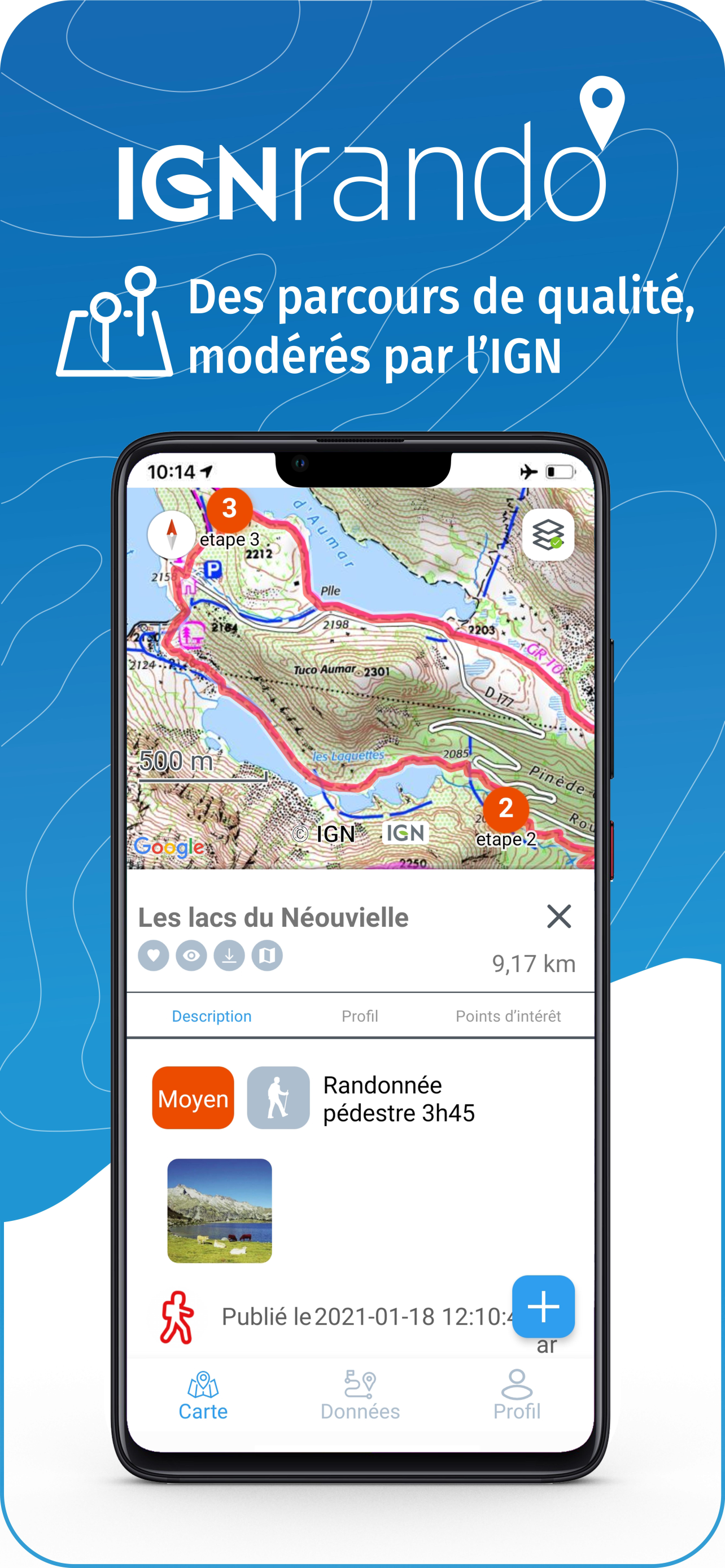
• Tens of thousands of available routes accross Metropolitan and Overseas France
• Choose the activity, difficulty and length to find routes around you or near any other place
• Download or mark as favorite the desired routes or POIs
MAPS & LAYERS IN FREE ACCESS (with internet connection)
• Plan IGN: most updated map, suitable for all activities
• Aerial photos (IGN)
• OpenStreetMap Outdoors: world map with hiking routes & contour lines
• OpenCycleMap: world map with cycling routes & contour lines
∙ Spain IGN map
∙ Swisstopo map
∙ Emergency calls (112) mobile network coverage map for France
∙ OpenSnowMap
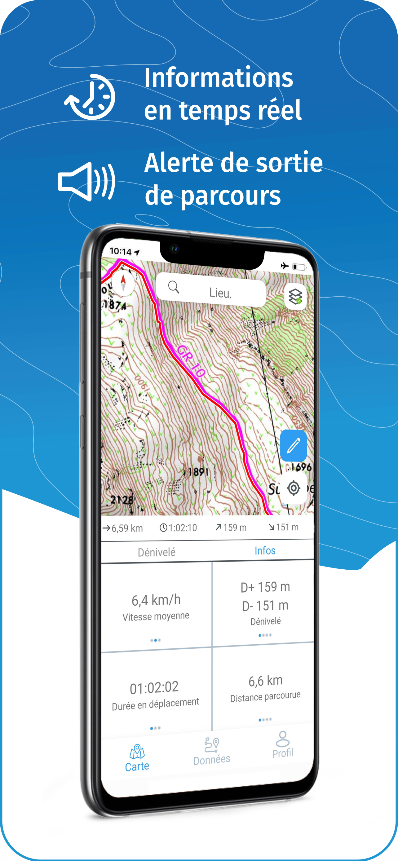
GPS GUIDING ALONG ROUTES
• See your progression on the map and on the elevation profile
• Get alerted if you exit the route
• Get notified of upcoming POIs or route info points (available soon)
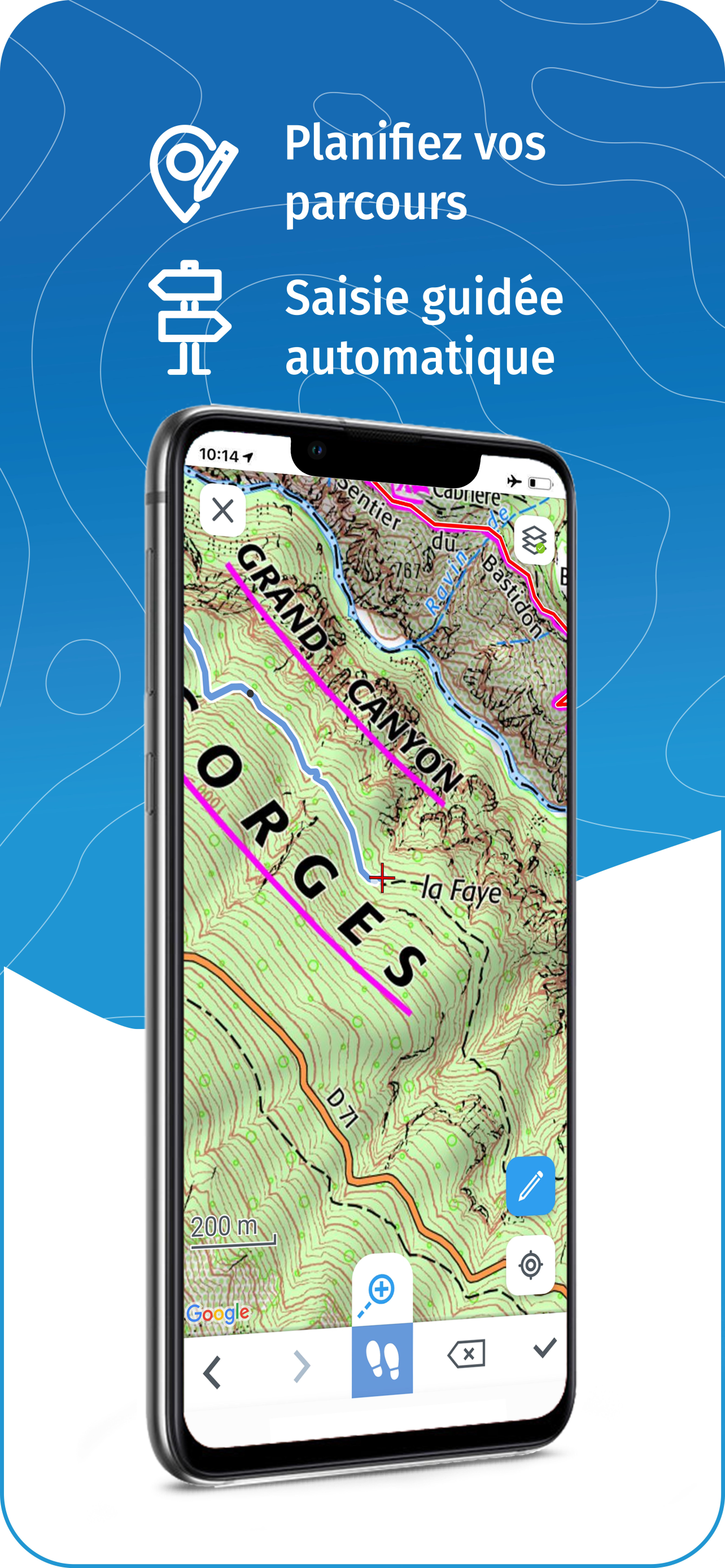
GPS TRACKING AND DATA CREATION
• Record your own routes using GPS
• Quickly create routes on-device with the automatic routing tool that follows roads and paths (online only, with subscription)
• Create Points of interest
• Export Routes or Points to save them locally (Files app) or share them
• Send your routes to ignrando.fr for backup or to publish them
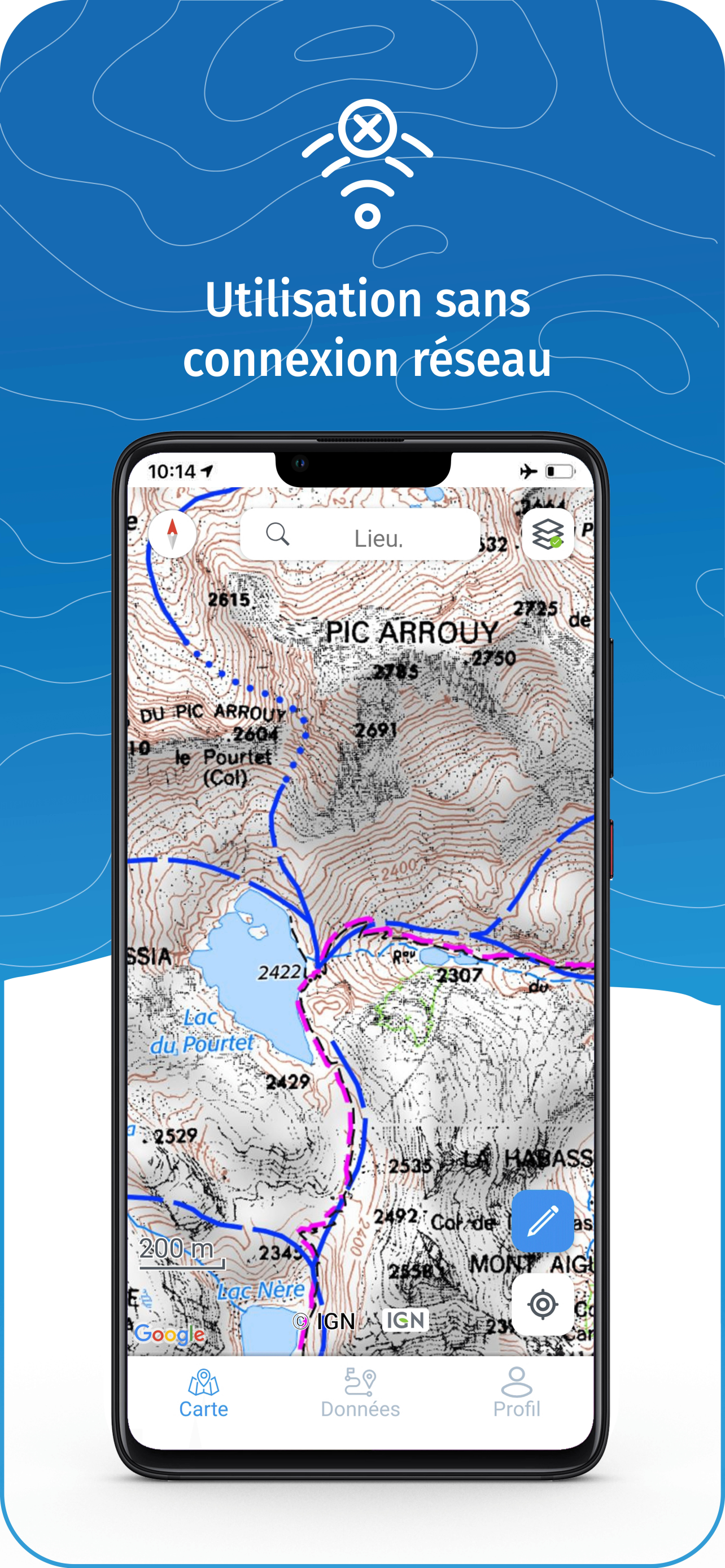
OFFLINE USE
• The GPS keeps working even without internet: see your position on the map, use GPS guiding and record routes
• Downloaded routes: descriptions, photos and guiding remain accessible
• Downloaded maps (with subscription)
USEFUL TIP: Enabling Airplane Mode or disabling Mobile Data improves battery life, without affecting the Location Services (GPS)
IGN MAPS SUBSCRIPTION
• Create routes with pedestrian and vehicle routing
• View & download the following maps & layers:
∙ All free version maps
∙ IGN maps (various scales)
∙ IGN 1:25k topo maps (Top 25): the famous French topographical maps available at all zoom levels
∙ 1950 IGN maps
∙ Military maps (1820-1866)
∙ ICAO aeronautical charts
∙ France mobile network operators coverage maps
∙ Slopes > 30° (useful for winter activites)
∙ Cadastral parcels layer
∙ DFCI grid (forest fire protection grid)
• Drones flight restriction areas
∙ Roads & paths layer (only available with Aerial photos)
IGNrando' store subscription
• Linked to IGNrando' account
• No automatic renewal
• Can be used on 3 devices at the same time
App Store subscription
• Linked to Apple account
• Automatic renewal unless cancelled at least 24 hours before the end of the current period
• Auto-renewal may be turned off by going to the user's Account Settings after purchase
• Any unused portion of a free trial period will be forfeited when the user purchases a subscription
WARNING: Ubicarta or IGN cannot refund subscriptions purchased on the App Store, only Apple can, at its sole discretion
ONLINE HELP (french only)
https://ignrando.ubicarta.com/help
FAQ (frequently asked questions - french only)
https://ignrando.ubicarta.com/faq
TERMS OF SERVICE
https://ignrando.ubicarta.com/terms
Fill in the boxes and press “Validez” (log in page doesn’t offer English version). One or more of the boxes is rejected. Refill it but now another box is rejected. Refill that box and a box is rejected, usually the first.
Giving up.
Keeps crashing!
Maps look good, soon as you click to select routes etc it just crashes and closed the app.
Tried reinstalling etc., just the same.
V poor, I’m used to the OS app in the UK, which is brilliant. Real shame.
Crashes
Wge
Génial
Il serait bien de proposer aussi un abonnement au mois sans engagement.
Impossible to create an account
Account created in the website (ver difficult as it is impossible to understand which account and area to address).then tried to use same user and password in the app. A non self explanatory error comes out. Pity as it seems to be a great app and I bought 4 paper maps. Will uninstall soon
Difficult to use
Lack of detail in “close ups”.
I try to discover moderate walking tours 20 km around (there are many) tap to see the results repeatedly. Nothing. Unless it improves, it is a waste of money.
Disappointed
Downloaded it. Created an account as requested... but it won’t show me any existing hikes: I get to the page, click on the options of interest and... it bugs there and doesn’t go to the results. Sure it’s a good app as it was recommended by friends but so far... Hum.
Absolutely ultimate maps
Absolutely amazing app. UI is just perfect and easy to use. Only problem- registration is a headache... tried twice, no luck. Not sure about zoom and map detalisation, but if noticed right zooming was better first time I opened app. Can’t zoom enough using online anymore , no details...
Mr currie
This app is not in English as described it is in French.
Does not give an option to change the language and unable to find how to subscribe. Already purchased 2 paper maps to download to my iPhone and no idea how to transfer to my phone through the app because I cannot change settings to English 🤔