Mytrip.com - 次回のフライトを予約

Professional Cad Solution

Published by: Svetlana Sandalova

Description

LidarCad combines CAD Editor and LiDAR Scanner into one Application. With LidarCad it is easy to estimate volumes of sand or gravel, capture point clouds, measure length, area and so on. LidarCad works with DWG/DXF files. Results can be exported to other popular formats.
Scan functionality available on LiDAR-enabled devices. It includes:
* Estimate cut/fill volumes using base plane
* Estimate cut/fill using limited boundary
* Capture point clouds
* Add points with XYZ(WGS) coordinates
* Define CS Origin for scan
* Measure length/area
Full description and manuals available on page: http://cadspace.xyz/Features/
CAD editor contains tools to create Drawings. It supports connection to your bluetooth rangefinder. Measurements transmitted directly to drawing, it is possible to set exact length for selected line, or add text with transmitted value. This is a list of supported devices:
* Bosch GLM50C, GLM100C, GLM120C
* Bosch PLR30C, PLR40C, PLR50C
* Leica DISTO D110, D1, D2
* Leica DISTO D510, D810, S910
* Leica DISTO X3, D8
* Condtrol Vector Rangefinders
For devices without LiDAR sensor full functional CAD editor available.
Hide Show More...

Screenshots

Mytrip.com FAQ

  • Is Mytrip.com free?

    Mytrip.com is not free (it costs 148.00), however it doesn't contain in-app purchases or subscriptions.

  • Is Mytrip.com legit?

    Not enough reviews to make a reliable assessment. The app needs more user feedback.

    Thanks for the vote

  • How much does Mytrip.com cost?

    The price of Mytrip.com is 148.00.

  • What is Mytrip.com revenue?

    To get estimated revenue of Mytrip.com app and other AppStore insights you can sign up to AppTail Mobile Analytics Platform.

User Rating
App is not rated in Hong Kong SAR China yet.
Ratings History

Mytrip.com Reviews

Complete Fraud

RonnieKelly on

United States

This software does not scan with iPhone LiDAR it is a AutoCAD drawing viewer. I was ripped off for $18

Great tool for underground mining and construction!

fromaster59 on

United States

Love this app, use it all time at the underground mine I work at. I was able to scan 300 ft of tunnel and match it with a survey scan. Perfect for scanning cross sections for ventilation stations and measuring distances. I can easily use the data in Maptek Point Studio and Trimble business center. Only complaint is that I can not export my scans as a las file I have to convert the pts file in Trimble in order to use it in Point Studio. So 6 ****** stars if you can add a las as export option.

Great updates

borysrush on

United States

I can now apply field codes to points as I create them. Several survey applications where this level of accuracy is acceptable. Great tool. Thank you for the amazing app!

Good

Enimar88 on

United States

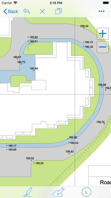
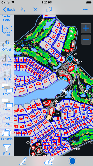
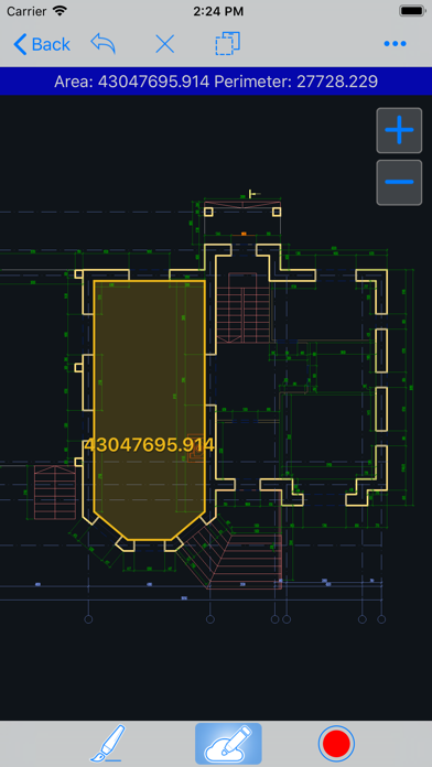
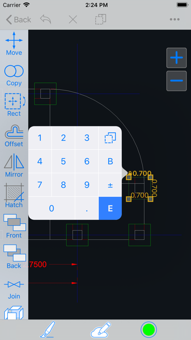
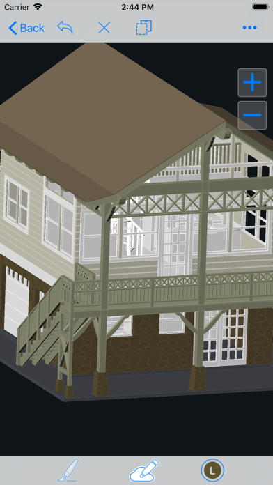
I use this app to view drawings.

Not working

jpx32 on

United States

Apple Pencil (2nd generation) doesn’t work in the app. I could not draw straight shapes. Appears extremely clunky & disfunctional. Why did I pay $17.99 for this?

Store Rankings

Ranking History
App Ranking History not available yet
Category Rankings
Chart
Category
Rank
Top Paid
171
Top Paid
214
Top Paid
229
Top Paid
243
Top Paid
244

Mytrip.com Competitors

LidarCad Installs

Last 30 days

LidarCad Revenue

Last 30 days

Mytrip.com Revenue and Downloads

Gain valuable insights into LidarCad performance with our analytics.
Sign up now to access downloads, revenue, and more.
This page includes copyrighted content from third parties, shared solely for commentary and research in accordance with fair use under applicable copyright laws. All trademarks, including product, service, and company names or logos, remain the property of their respective owners. Their use here falls under nominative fair use as outlined by trademark laws and does not suggest any affiliation with or endorsement by the trademark holders.