LidarCad combines CAD Editor and LiDAR Scanner into one Application. With LidarCad it is easy to estimate volumes of sand or gravel, capture point clouds, measure length, area and so on. LidarCad works with DWG/DXF files. Results can be exported to other popular formats.
Scan functionality available on LiDAR-enabled devices. It includes:
* Estimate cut/fill volumes using base plane
* Estimate cut/fill using limited boundary
* Capture point clouds
* Add points with XYZ(WGS) coordinates
* Define CS Origin for scan
* Measure length/area
Full description and manuals available on page: http://cadspace.xyz/Features/
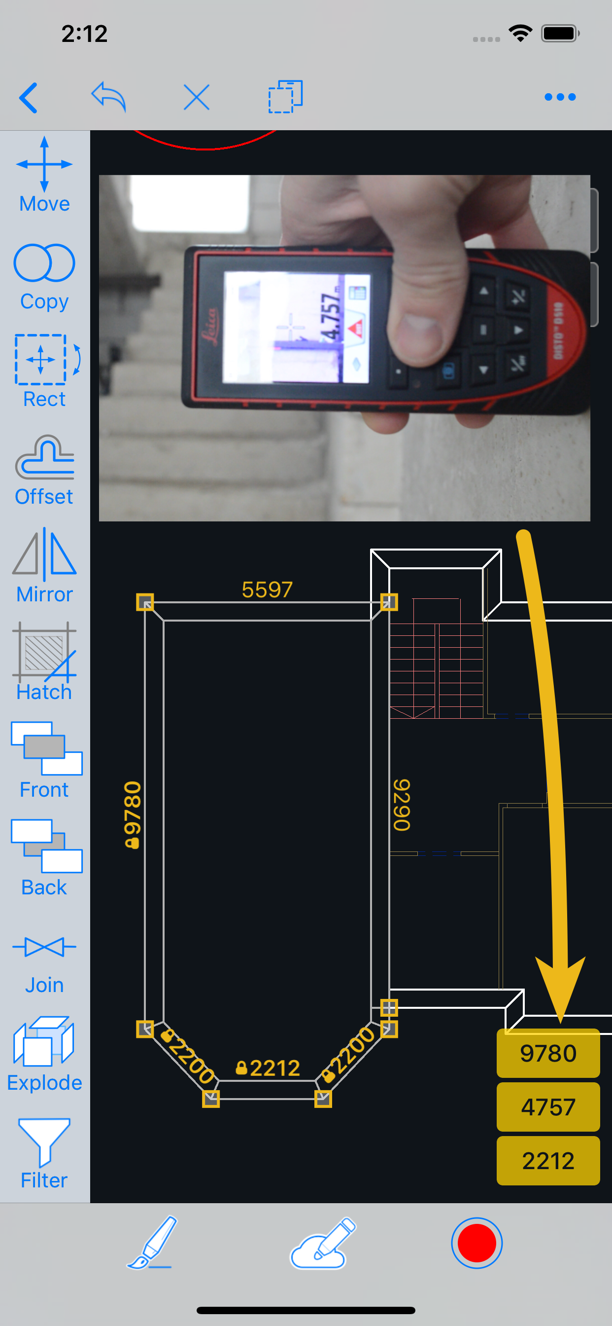
CAD editor contains tools to create Drawings. It supports connection to your bluetooth rangefinder. Measurements transmitted directly to drawing, it is possible to set exact length for selected line, or add text with transmitted value. This is a list of supported devices:
For devices without LiDAR sensor full functional CAD editor available.
Hide..Show more..
Screenshots
User Rating
3.8 out of 5
5 ratings
in United Kingdom
5 star
2
4 star
2
3 star
0
2 star
0
1 star
1
Ratings History
Reviews
Yes but almost
Almost what we need. Unfortunately we still need to convert the point cloud in recap as no rcp Rcs export option.
There doesn’t seem to be a way to create a textured mesh from the images like some of the other 3d scan apps which would be very useful where text is hard to make out from a point cloud. Presumably the images/video isn’t saved from the scan?
Also have an error NLS files missing Roman Mac to ansi 1252 when trying to open in windows autocad.
Display with Line weight would be a good option as is difficult to see while drawing. We tried changing but the view was unaffected.
Fading the pointcloud or setting transparency would be another useful option to have.
Otherwise.. fast and easy to use scanner with a good amount of tools to mark up for use in cad software.
Waste of money
Not what I was expecting does not have scan to plan function that I could find , very poor if any instructions how to use it. Pay up front , no trial period waste of money .
Brilliant..
As part of my job I have to manage stockpiles of rock salt for the gritting of roads during winter and the volume measurement ability of this app will be very useful. I tested the app against a known quantity of 1,400 tons (1,400/1.378 m3) of rock salt in the barns and it proved very very accurate. Delighted.
Lidar survey to cad
A great survey tool, wall and surface recognition.. Outputs straight to AutoCAD to convert the mesh to surface in civil 3D (ensure you use the in app explode feature to ensure Civil3d can create the surface). This allows the production of sections through the Point cloud or triangulated planes.
LidarCad Survey
Early impressions are that this is the software to use if you are completing site surveys into CAD programmes. It’s compatible with the programme I use, and makes the CAD collection from site so much quicker and impressive.