Looking for the most comprehensive software solution for flight simulation? Navigraph Charts is your co-pilot.
Navigraph Charts 8 has been developed with emphasis on delivering a seamless and intuitive experience, reducing the pilot workload in all phases of the simulated flight.
Why you'll always want Navigraph Charts with you in the cockpit:
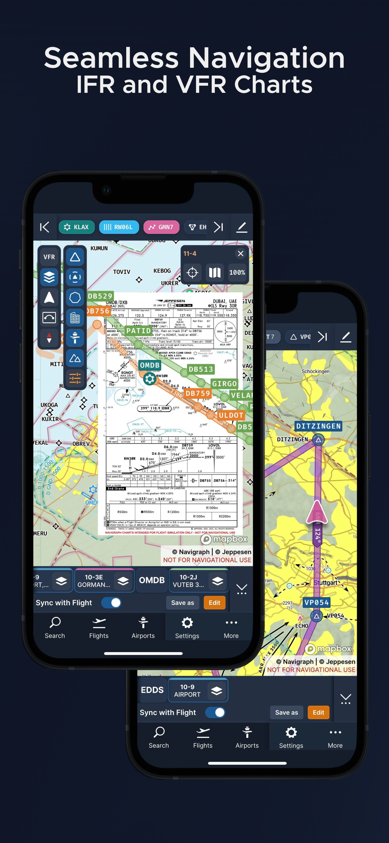
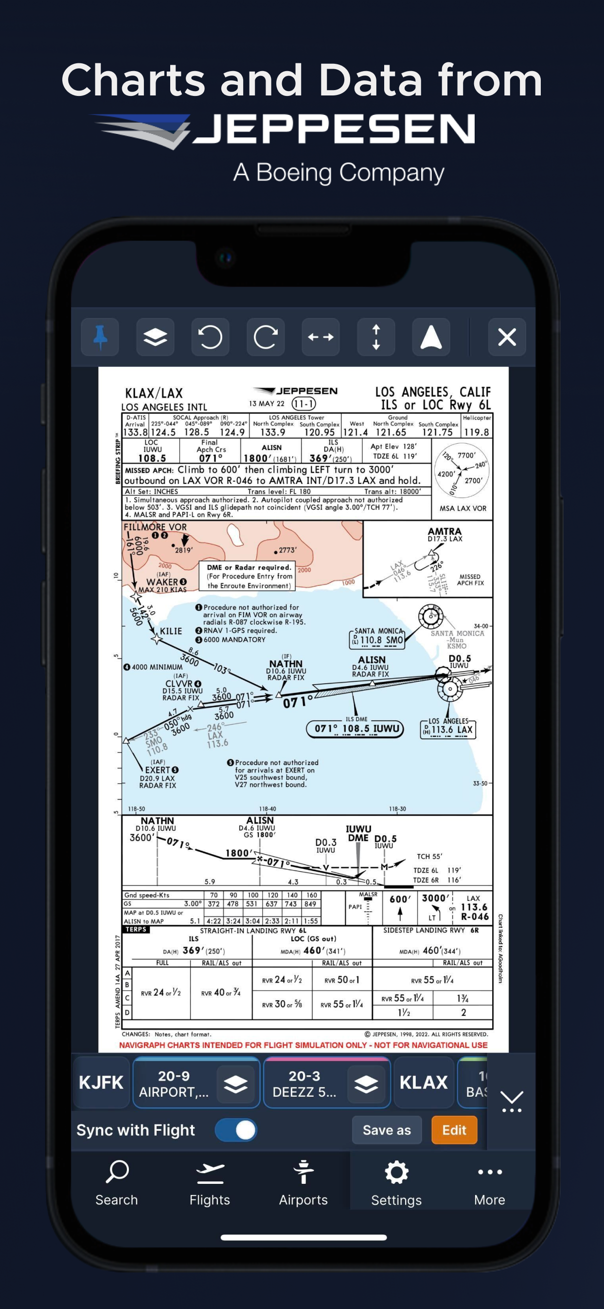
- Only provider of Jeppesen charts and navigation data for flight simulation.
- Access to IFR chart coverage at over 7,000 airports worldwide.
- Charts and data sourced from Jeppesen and updated every 28 days according to the AIRAC calendar.
- Largest dataset of its kind in the world.
- Most up-to-date and modern navigation software for flight simulation.
- Simulator sceneries, flight plans, charts, navigation systems, and addon software are all in sync with data from the same source.
- Great support.
New features in Navigraph Charts 8:
- Worldwide VFR Charts powered by Jeppesen VFR data
- Seamless Zoom
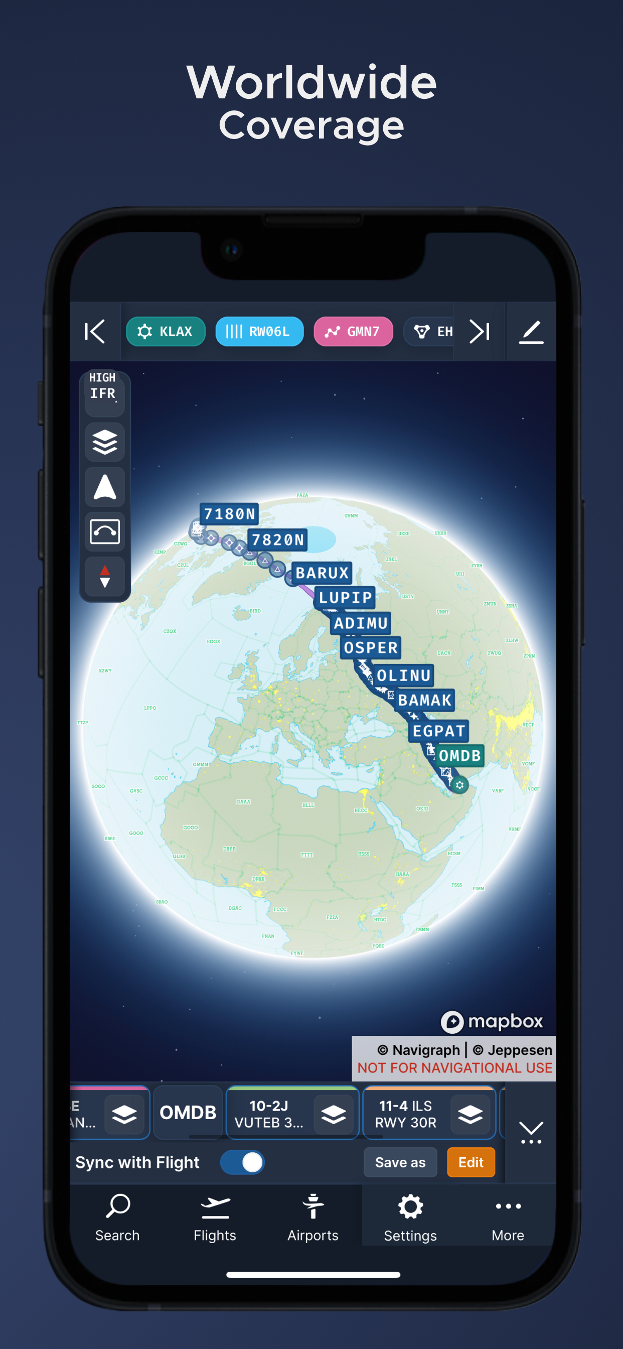
- 3D Globe Projection
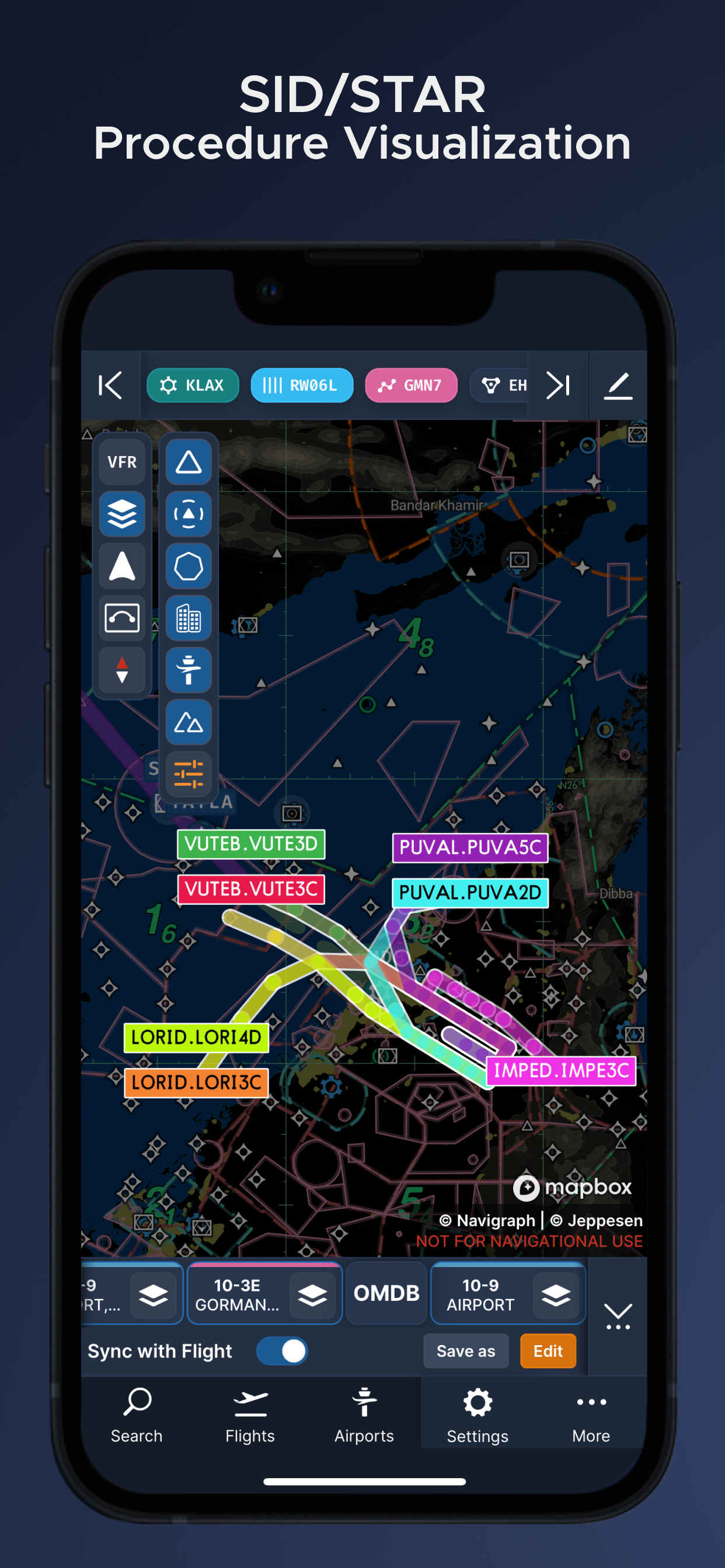
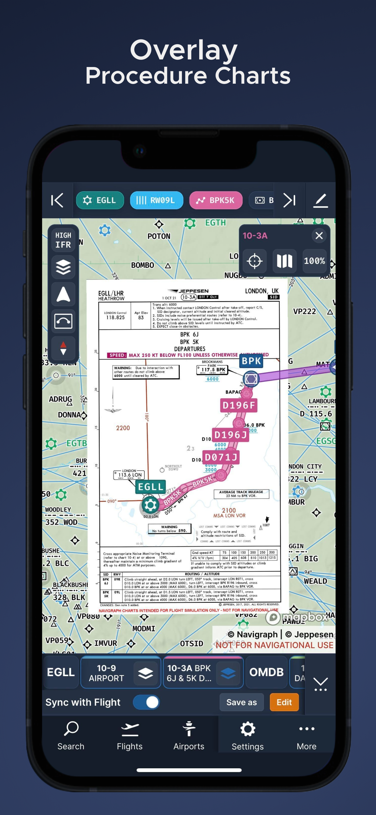
- Autopinning of Procedure Charts
- Runway Crosswind and Airport Weather Information
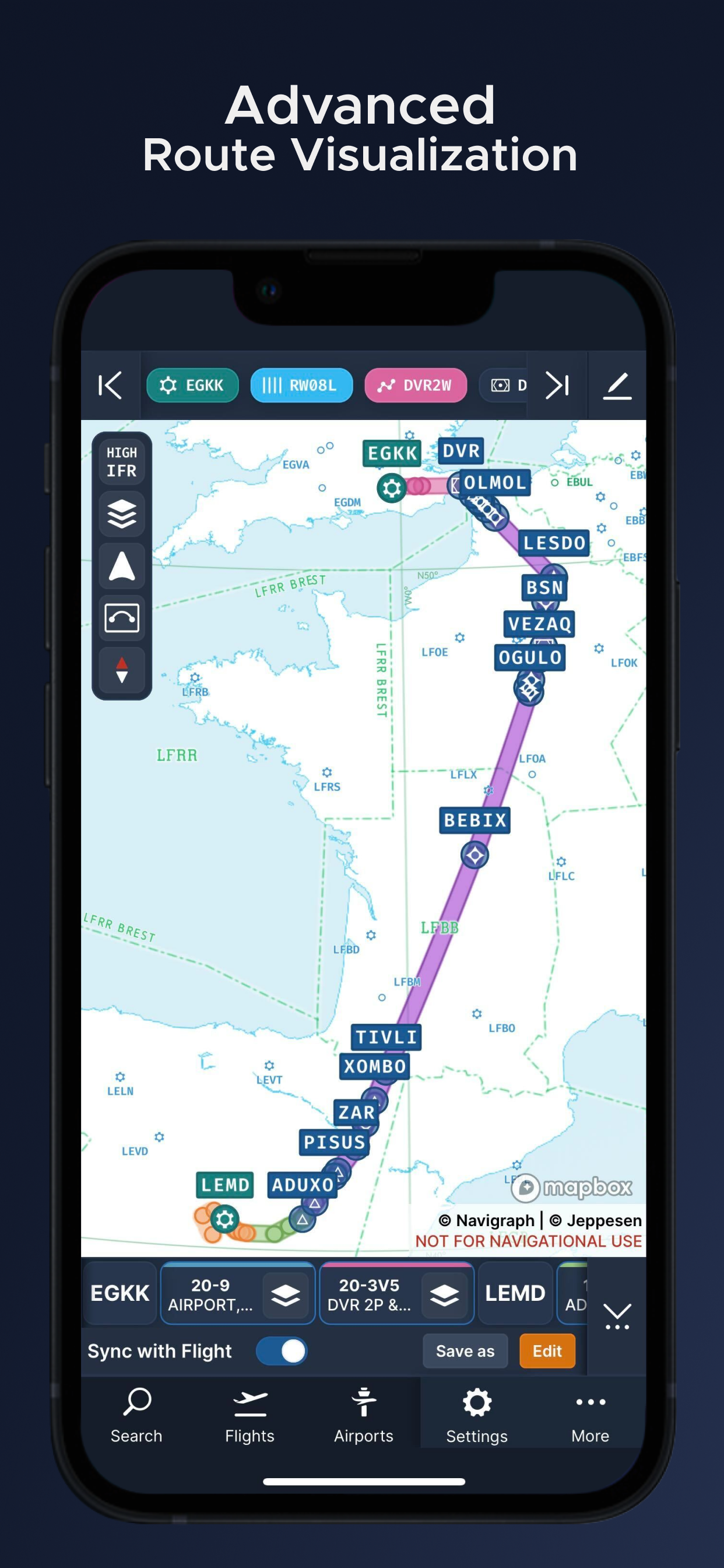
- Vector Charts
- Weather overlays including radar and winds
- ATIS
- NOTAM
- Annotate and draw on charts and SimBrief operational flight plan
Navigraph Unlimited features:
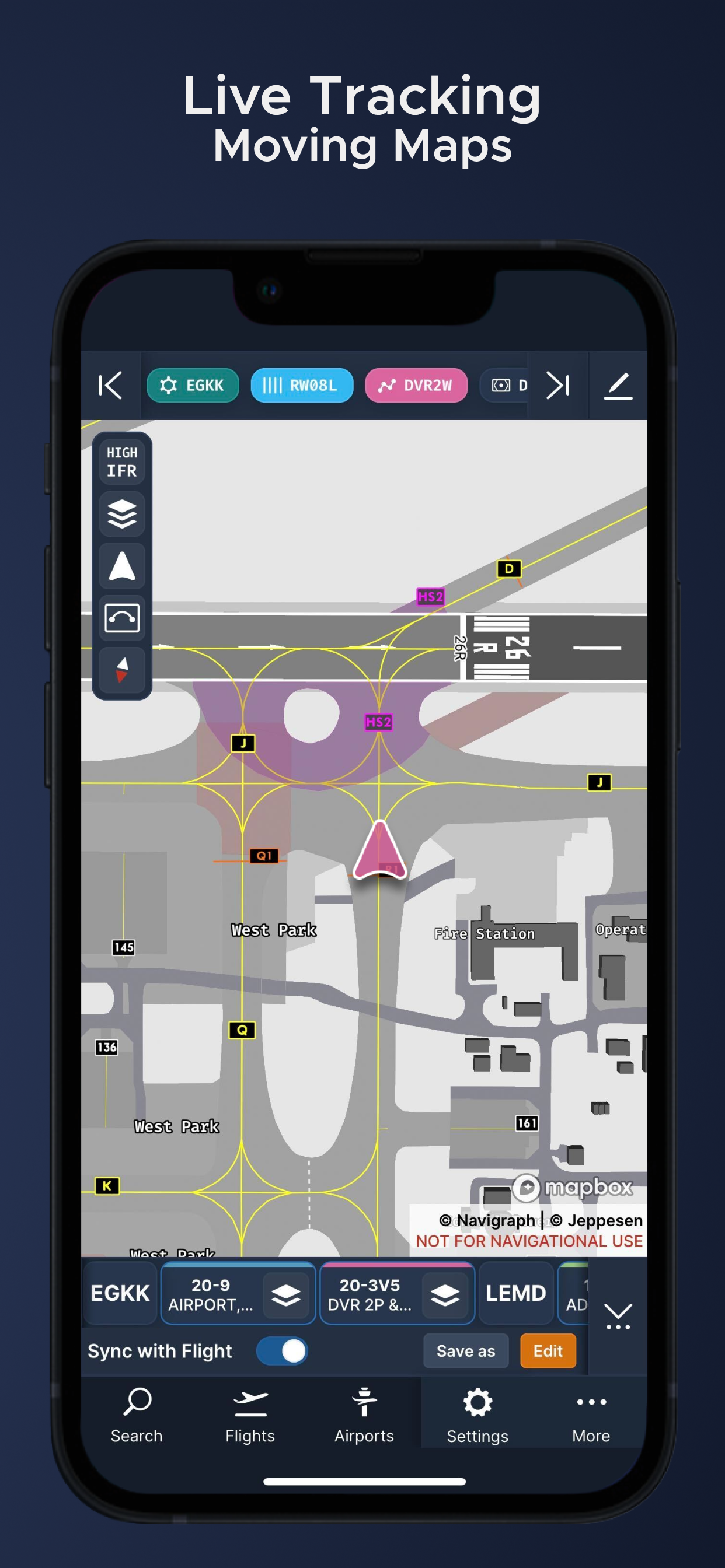
- Moving Maps
- Zoom all the way down to gate level.
- 3D globe projection helps visualize Great Circle distances and polar routes.
- Saves time and effort by automatically organizing relevant airport charts to pinboard.
- Weather information including runway crosswinds updated in real-time.
- No commitment - cancel any time you like.
Moving Maps compatible with Microsoft Flight Simulator, X-Plane and Prepar3d.
Hide..Show more..
Screenshots
User Rating
5 out of 5
41 ratings
in Poland
5 star
41
4 star
0
3 star
0
2 star
0
1 star
0
Ratings History
Reviews
A good start!
This app is a tiny bit buggy since this is a very first version for the iPhone. A “compass” button may not be working. After close zoom to the airport area to see its taxiways and stands layouts, IFR overlays may be vanished when switching to some another parts of the world map, which requires a restart to bring them back to work, sadly.
However, I doesn’t really bother me. This app feels absolutely amazing. Map and charts are clean and crystal sharp. I’m having a real pleasure just discovering the map and clicking buttons here. It really feels like this app was made by people who really love what they are doing and who are ready to share theirs love with others through this amazing app. Can’t wait for my next flight sim session using this app from my iPhone, it will be terrific. Thank you so much:)