Complete out of date , the route was planned through a lock closed decades ago!!!!
Completely useless and dangerous,


Yes, Waterkaarten is free to download, however it contains in-app purchases or subscription offerings.
🤔 The Waterkaarten app's quality is mixed. Some users are satisfied, while others report issues. Consider reading individual reviews for more context.
Waterkaarten has several in-app purchases/subscriptions, the average in-app price is £28.99.
To get estimated revenue of Waterkaarten app and other AppStore insights you can sign up to AppTail Mobile Analytics Platform.

4.42 out of 5
74 ratings in United Kingdom
Completely useless and dangerous,
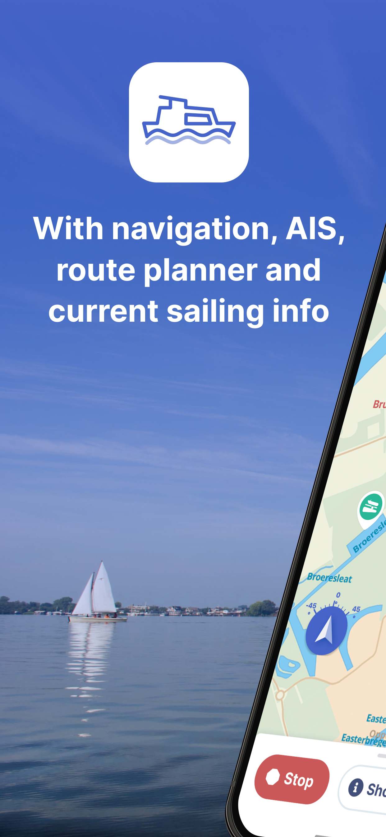
Transitted the "Mast Up" route from Amsterdam to Vlissingen in July 24. I had just been introduced to Waterkaarten and found this a fantastic help going through the canals and with the bridges and locks on the way. It was so much easier than the last time I did thois a few yeasr ago without Waterkaarten. I would strongly recommend this app to anyone traveling the Dutch canals
Clicked an ad and downloaded. Have to register only to find out it's a 7 day free trial. No mention anywhere that this was for a trial. Bit disappointing so deleted straight away.
Bugged. Won’t even get past the password
As a Brit the go to App for sailing in Netherlands waters is Waterkaarten. Thanks
Never had a better marine navigation app. All info needed, and much more, is there and always accurate. Highly recommend when navigating the European inland waterways
This was a brilliant app but what has happened to the mapping in the 2020 version? It’s awful! Used to love planning as well as navigating with this but I’ll be digging out my paper maps. A dreadful retrograde step
It’s very detailed and useful But it is in Dutch language. Which makes it difficult to find the the information you need
The information offered is brilliant and very helpful, exactly what you need. Planning routes however is quite difficult and the worst fault of all is that the routes cannot be edited, so if you make a mistake, want to shorten or lengthen a route you have to start again from scratch. You can’t even edit the name of the route.
Found this when cruising this summer and thought it was great. You could nav by it if you wanted and we did in part though had plotter in cockpit. Where it is great is tap a feature and it identifies it. Tap again and you get all the details available such as contacts, opening times etc. In heavy winds we were approaching Zeeland bridge and some distance off saw bridge open. Checked the app and it was at the time the app said so had confidence to get a move on to make next opening time. Can’t fault it
|
Chart
|
Category
|
Rank
|
|---|---|---|
|
Top Grossing
|

|
14
|
|
Top Grossing
|

|
43
|
|
Top Grossing
|

|
55
|
|
Top Grossing
|

|
65
|
|
Top Free
|
|
82
|
