CuteMe:만화 스타일&ai 그림&애니메이션 만들기

Bild till PDF & PDF läsare

Veröffentlicht von: OsmAND

Beschreibung

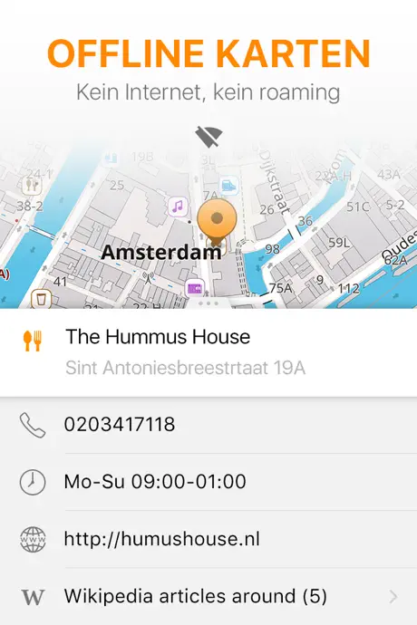
OsmAnd ist eine Offline-Weltkartenanwendung auf Basis von OpenStreetMap (OSM), mit der Sie unter Berücksichtigung der bevorzugten Straßen und Fahrzeugabmessungen navigieren können. Planen Sie Routen basierend auf Steigungen und zeichnen Sie GPX-Tracks ohne Internetverbindung auf.
OsmAnd ist eine Open-Source-App. Wir sammeln keine Nutzerdaten und Sie entscheiden, auf welche Daten die App Zugriff hat.
Haupteigenschaften:
Kartenansicht
• Auswahl der auf der Karte anzuzeigenden Orte: Sehenswürdigkeiten, Essen, Gesundheit und mehr;
• Suche nach Orten nach Adresse, Name, Koordinaten oder Kategorie;
• Kartenstile für die Bequemlichkeit verschiedener Aktivitäten: Tourenansicht, Seekarte, Winter und Ski, topografisch, Wüste, Offroad und andere;
• Schattierungsrelief und steckbare Konturlinien;
• Möglichkeit, verschiedene Kartenquellen übereinander zu legen;
GPS Navigation
• Zeichnen einer Route zu einem Ort ohne Internetverbindung;
• Anpassbare Navigationsprofile für verschiedene Fahrzeuge: Autos, Motorräder, Fahrräder, 4x4, Fußgänger, Boote, öffentliche Verkehrsmittel und mehr;
• Ändern Sie die erstellte Route unter Berücksichtigung des Ausschlusses bestimmter Straßen oder Straßenoberflächen;
• Anpassbare Informations-Widgets über die Route: Entfernung, Geschwindigkeit, verbleibende Fahrzeit, Entfernung zum Abbiegen und mehr;
Routenplanung und Aufzeichnung
• Zeichnen einer Route Punkt für Punkt mit einem oder mehreren Navigationsprofilen;
• Routenaufzeichnung mit GPX-Tracks;
• GPX-Tracks verwalten: eigene oder importierte GPX-Tracks auf der Karte anzeigen und durch diese navigieren;
• Visuelle Daten über die Route - Abfahrten/Aufstiege, Entfernungen;
• Möglichkeit, GPX-Tracks in OpenStreetMap zu teilen;
Erstellen von Punkten mit unterschiedlicher Funktionalität
• Favoriten;
• Markierungen;
OpenStreetMap
• Bearbeiten von OSM;
• Kartenaktualisierung mit einer Häufigkeit von bis zu einer Stunde;
Zusatzfunktionen
• Kompass- und Radiuslineal;
• Mapillary-Schnittstelle;
• Nachtthema;
• Große Benutzer-Community auf der ganzen Welt, Dokumentation und Support;
Kostenpflichtige Funktionen:

Maps+ (In-App oder Abonnement)
• Apple CarPlay-Unterstützung;
• Unbegrenzte Kartendownloads;
• Topodaten (Höhenlinien und Gelände);
• Nautische Tiefen;
• Offline-Wikipedia;
OsmAnd Pro (Abonnement)
• Alle Maps+-Funktionen;
• OsmAnd Cloud (Sicherung und Wiederherstellung);
• Wettervorhersage auf der Karte online/offline;
• Routenlinie anpassen;
• Stündliche Kartenaktualisierungen.
Ausblenden Mehr anzeigen...

In-App-Käufe

OsmAnd Pro Monatlich
CHF 2.50
OsmAnd: All inclusive Jährlich
CHF 9.00
Contour lines
CHF 9.00
Europa
CHF 15.00
Alle Weltkarten
CHF 20.00
OsmAnd Maps+ Jährlich
CHF 10.00
OsmAnd Pro Jährlich
CHF 30.00
OsmAnd Maps+
CHF 40.00
OsmAnd:All Inclusive Monatlich
CHF 2.00

Screenshots

CuteMe:만화 스타일&ai 그림&애니메이션 만들기 Häufige Fragen

  • Ist CuteMe:만화 스타일&ai 그림&애니메이션 만들기 kostenlos?

    Ja, CuteMe:만화 스타일&ai 그림&애니메이션 만들기 ist kostenlos herunterzuladen, enthält jedoch In-App-Käufe oder Abonnements.

  • Ist CuteMe:만화 스타일&ai 그림&애니메이션 만들기 seriös?

    🤔 Die Qualität der CuteMe:만화 스타일&ai 그림&애니메이션 만들기-App ist gemischt. Einige Nutzer sind zufrieden, während andere Probleme melden. Ziehen Sie in Betracht, einzelne Bewertungen für mehr Kontext zu lesen.

    Danke für die Stimme

  • Wie viel kostet CuteMe:만화 스타일&ai 그림&애니메이션 만들기?

    CuteMe:만화 스타일&ai 그림&애니메이션 만들기 bietet mehrere In-App-Käufe/Abonnements, der durchschnittliche In-App-Preis beträgt CHF 15.28.

  • Wie hoch ist der Umsatz von CuteMe:만화 스타일&ai 그림&애니메이션 만들기?

    Um geschätzte Einnahmen der CuteMe:만화 스타일&ai 그림&애니메이션 만들기-App und weitere AppStore-Einblicke zu erhalten, können Sie sich bei der AppTail Mobile Analytics Platform anmelden.

Benutzerbewertung

4.51 von 5

593 Bewertungen in Schweiz

5 star
420
4 star
106
3 star
35
2 star
12
1 star
20
Bewertungsverlauf

CuteMe:만화 스타일&ai 그림&애니메이션 만들기 Bewertungen

Crash, crash, crash on 7th gen iPad

Portgselvadi on

Schweiz

I own an 7th gen iPad with latest iOS 18.1.1. While I‘m used to reduced performance due to the older hardware, I‘m absolutely not used on my device to any crashing apps like OsmAnd does. It crashes on launch, it crashes on loading maps, it crashes on zooming in and out. It is simply useless. I have never seen such poor stability with any app I ever downloaded from AppStore. I give two stars because of OpenStreet Map and because of the impressive potential OsmAnd may have. But it should be zero stars, to be honest.

Super App - aber crasht andauernd

Kisriel on

Schweiz

Eigentlich die beste App ever - seit ein paar Tagen crasht sie aber alle 30 Sekunden. Hoffe, das wird bald behoben. 😬

Interesting idea and concept

CoreForce on

Schweiz

The idea and concept of the app is very appealing. The learning curve is steep, as it has a ton of features and profiles, which all need to be configured before it can be used. The CarPlay implementation, a paid feature, is very rudimentary and not really worth a paid subscription. After a while the app keeps crashing when try to navigate. Having to manually confirm each download of maps is a pita (and contributing to crashes as it seems). Search function is not particularly good.

Lifetime Pro

zonk257 on

Schweiz

Bought a lifetime ‚Plus‘ upgrade, but CarPlay and Relieve are only available with ‚Pro‘, which you only get in subscription. Don’t like such licensing models and will therefore not use OsmMap, until the mentioned features are in Plus or Pro is available as lifetime.

User interface not responding

EineVoVielne on

Schweiz

on my average iphone 11 you simply cant tab the buttons they wont respond

Not bad

Eggheadbrvehhsvdbvs on

Schweiz

It has some quirks, but is generally responsive and the information in it seems reasonable. The one thing that drives me nuts is the handling of POIs (grocery stores, etc..), which I think is one of the most fundamental features, and hence the 3-star review. For one each time you search for anything your selection of POIs disappears, and you need to go back in and select all the POIs you care about. This is super frustrating because I'm trying to find say a POIs close to a specific location, but then each time I search for a location I then need to go and re-add all the POIs I'm looking for. The second annoyance being that many POI types (including supermarkets) are hidden by default. They only way to get a POI type added to your list of selectable POIs is to first search for a specific POI of that type. For example for supermarkets you first need to find a supermarket on the map before you can enable supermarkets in your list of POIs. Please, please, please fix this. They're such fundamental features that really impede usability.

Ça plante souvent c’est normal?

fabbagate on

Schweiz

Peu intuitif et pratique au début en tous cas

Please purchase continents to update the map

gjggki Nicknsme Taken on

Schweiz

How to purchase it? I don’t want a monthly plan. One off payment.

L’outil ultime de cartographie en voyage

DidierBurkhalter on

Schweiz

Les différentes cartographies sont riches et détaillées et les fonctionnalités sont très complètes. Je note particulièrement: - le partage de fichiers Gpx par AirDrop et particulièrement les fichiers de cartographie pour éviter de les télécharger à l’étranger lors de voyages, et échangeables entre appareils du même compte. - la possibilité de partager les paramètres sur un appareil Androïd. - la fonction CarPlay ❤️ - la création et la consultation de traces.

Not suitable for car navigation

MxLaP on

Schweiz

It is not useful for car navigation as it can’t cope with tunnels. It will freeze until it gets signal from GPS so you might miss exits. Google Maps is way better. Also destination search is not convenient. Main use was following gpx tracks and some bike routing for which it is o.k. But tends to crash when zooming maps on I Phone. Also searching map is not easy as it defaults to current position always when moving map. Maps are not topo so for bike nav have now replaced it with Komoot and Outdooractive. In my opinion not first choice anymore.

Store-Rankings

Ranking-Verlauf
Kategorien-Rankings
Diagramm
Kategorie
Rang
Top Umsatz
2
Top Umsatz
5
Top Umsatz
6
Top Umsatz
7
Top Umsatz
7

Schlüsselwörter

CuteMe:만화 스타일&ai 그림&애니메이션 만들기 Konkurrenten

OsmAnd Maps Travel & Navigate Installationen

Letzte 30 Tage

OsmAnd Maps Travel & Navigate Umsatz

Letzte 30 Tage

CuteMe:만화 스타일&ai 그림&애니메이션 만들기 Einnahmen und Downloads

Gewinnen Sie wertvolle Einblicke in die Leistung von OsmAnd Maps Travel & Navigate mit unserer Analytik.
Melden Sie sich jetzt an, um Zugriff auf Downloads, Einnahmen und mehr zu erhalten.

App-Informationen

Kategorie
Travel
Herausgeber
OsmAND
Sprachen
Afrikaans, Albanian, Arabic, Aragonese, Armenian, Azerbaijani, Basque, Belarusian, Bengali, Bosnian, Breton, Bulgarian, Burmese, Catalan, Croatian, Czech, Danish, Dutch, English, Esperanto, Estonian, Finnish, French, Galician, Georgian, German, Greek (modern), Hebrew (modern), Hindi, Hungarian, Icelandic, Indonesian, Interlingua, Italian, Japanese, Kannada, Korean, Kurdish, Latvian, Lithuanian, Macedonian, Malayalam, Marathi, Mongolian, Norwegian Bokmål, Norwegian Nynorsk, Occitan, Persian, Polish, Portuguese, Panjabi, Romanian, Russian, Sardinian, Serbian, Chinese, Slovak, Slovene, Spanish, Swedish, Tamil, Tatar, Telugu, Chinese, Turkish, Ukrainian, Urdu, Uzbek, Vietnamese, Welsh
Letzte Veröffentlichung
5.1.3 (vor 1 Woche )
Veröffentlicht am
Apr 21, 2015 (vor 10 Jahren )
Zuletzt aktualisiert
vor 4 Tagen
This page includes copyrighted content from third parties, shared solely for commentary and research in accordance with fair use under applicable copyright laws. All trademarks, including product, service, and company names or logos, remain the property of their respective owners. Their use here falls under nominative fair use as outlined by trademark laws and does not suggest any affiliation with or endorsement by the trademark holders.