Planimeter - Measure Distance, Area & Land on map with GPS
Measure distances, areas, and perimeters directly on map — fast, accurate, and easy to use. Whether you're a land surveyor, real estate agent, contractor, farmer, landscaper, or just planning your backyard, Planimeter helps you measure on map or on Earth anything with just a few taps on screen.
# Powerful GPS Mapping & Land Measurement Tool
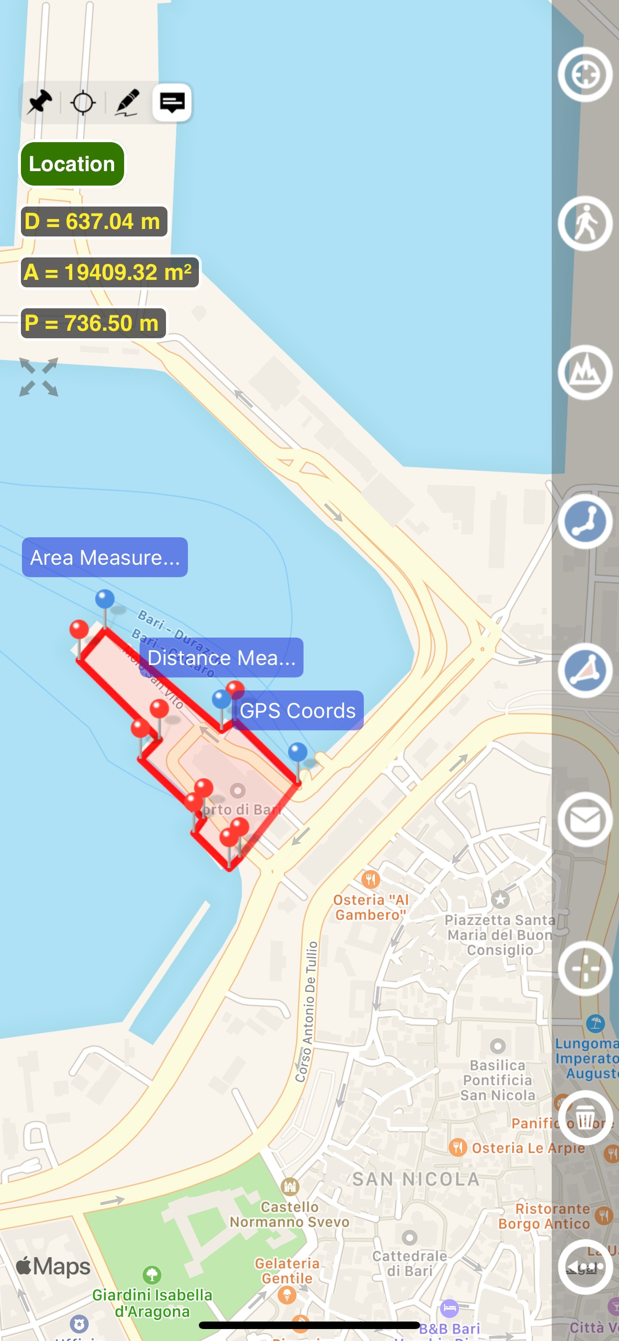
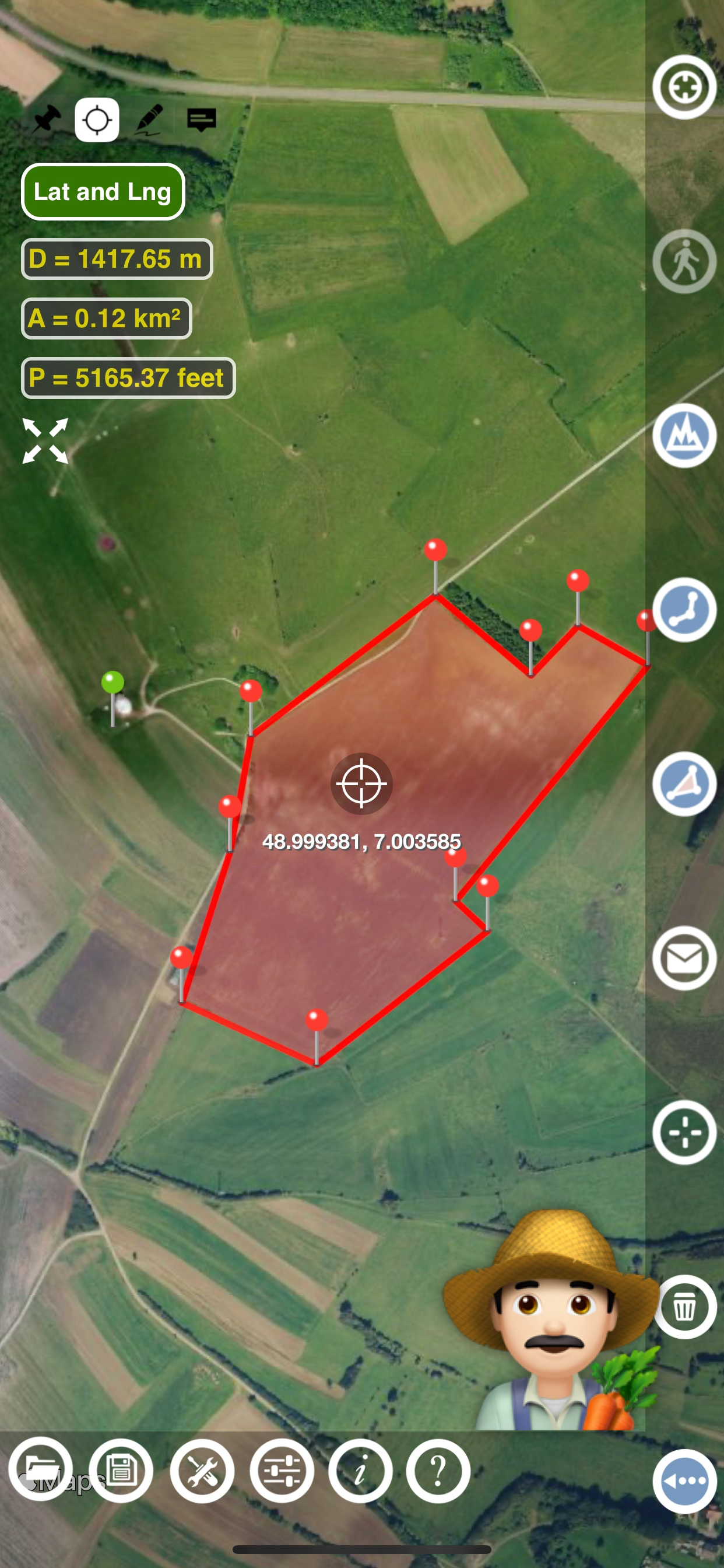
Planimeter turns your iPhone or iPad into a professional-grade mapping and measurement tool. Use touch on the screen with your finger or GPS tracking to place points on the map and instantly calculate area, perimeter, and distances. Measure fields, properties, roads, trails, roofs, fences, and more.
# Features
- Accurate distance measurements
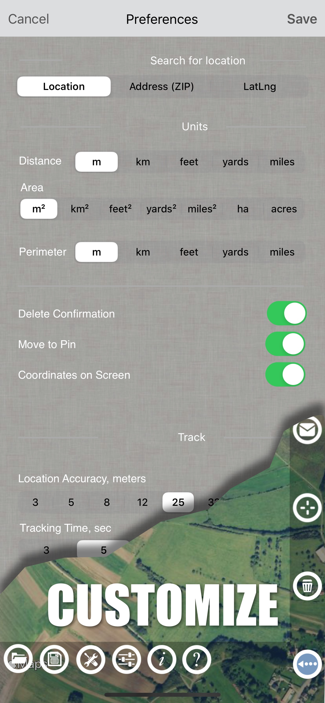
- Metric and Imperial units (m, km, feet, yards, miles, ha, acres)
- GPS accuracy settings (if GPS available)
- Current location search
- Delete selected/last/all points
- Zoom to Fit-in and center points on a screen - quick points search
- Add points by touch
- Add the current location as a point
- Option to center the point added
- Option to show/hide lines
- Preferences: accuracy, tracking time interval, delete points confirmation, sound option for
tracking
- Separate units settings for distance, area, and perimeter.
# Premium Features (Require Subscription)
- Area calculation
- Angle between lines
- Bearings to and from the point
- Forward and backward navigation through points by touch on the Info Panel
- GPS coordinates of a point
- Manage previously saved projects: open, save, share KML files
- KML files created by Planimeter can be imported to GEarth and GMaps to view on a desktop
- Send data by email: picture, coordinates as a text message, KML file
- Save KML or TXT in local storage
- Map/Satellite View
- Zoom and Edit points
- Text (address) search
- Find the location by entering the Latitude and Longitude coordinates
- Add points by entering geo-coordinates: Lat and Lng
- Target Mode for accurate pin placement
- Show current coordinates in Target Mode
- Draw (Stylus) Mode
- Notes Mode
# Perfect For:
- Land surveying and boundary mapping
- Real estate lot size and property planning
- Farming & agriculture (field size, fencing, planning)
- Construction, paving, roadwork
- Solar panel installation (roof area estimation)
- Landscaping, lawn care, and garden design
- Outdoor sports, hiking, golf course planning, trail measurement
- Forestry, damage assessment, and more
# Learn More
Quick Start Guide on this page:
https://www.vistechprojects.com/vistech-projects-downloads
Video Demo: https://youtu.be/unjYbPCIYM0
# Note
Continued use of GPS running in the background can significantly reduce battery life.
# Loved by Professionals & DIY Users
Planimeter is trusted worldwide by professionals in surveying, agriculture, real estate, solar energy, and construction, as well as homeowners and outdoor enthusiasts. Join thousands of users simplifying their land measurement tasks today.
# Questions or feedback? Contact us at
[email protected]