
Description
Explore a fresh perspective on the world with AIS Maps: Marine and Lakes Charts from FlyToMap. Our app is meticulously designed, offering a seamless blend of aesthetic appeal and functionality. Witness the world in intricate detail, thanks to vector-based map elements that maintain their sharpness even when zoomed in, and experience smooth panning, tilting, and rotating for a consistently immersive view.
Unlock the full potential of FlyToMap with our in-app purchase business model, providing access to a comprehensive array of maps, including Marine, Travel, Parks, and Lakes. All these maps are available for offline use at reasonable costs.
Key Features:
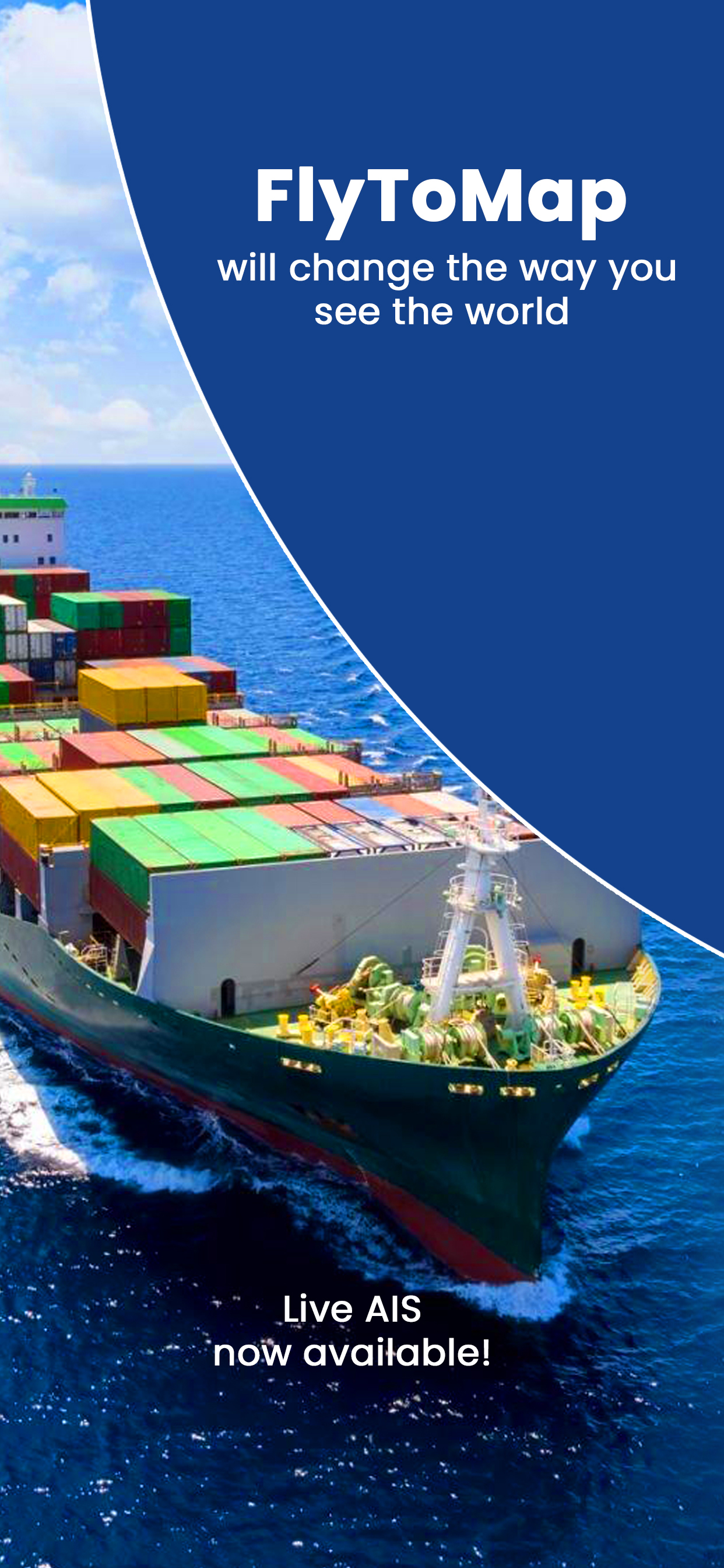
Live AIS:
Experience real-time map views of your boat and nearby vessels worldwide without the need for an AIS receiver—just your mobile device. Various icons denote different vessel categories, and selecting a target reveals detailed information such as name, MMSI, IMO, call sign, status, speed, heading, coordinates, distance from your GPS location, and more.
Free Features and Functions:
Latitudes and Longitudes for easy navigation
Direct search for your favorite points
Intuitive zoom, rotate, and pan with a touch
Quick object information with vector technology
GPS heading for precise navigation
Distance measurement tool for easy calculations
Route planning with real-time speed, distance, and bearing updates
Magnifying lens for detailed information
Unlimited tracks, markers, geo-tagged photos, and records
Shareable via email and visible on Google, Flytomap Viewer, and KMZ format
Depth contours selection
Background functionality for multitasking
Optimized battery usage
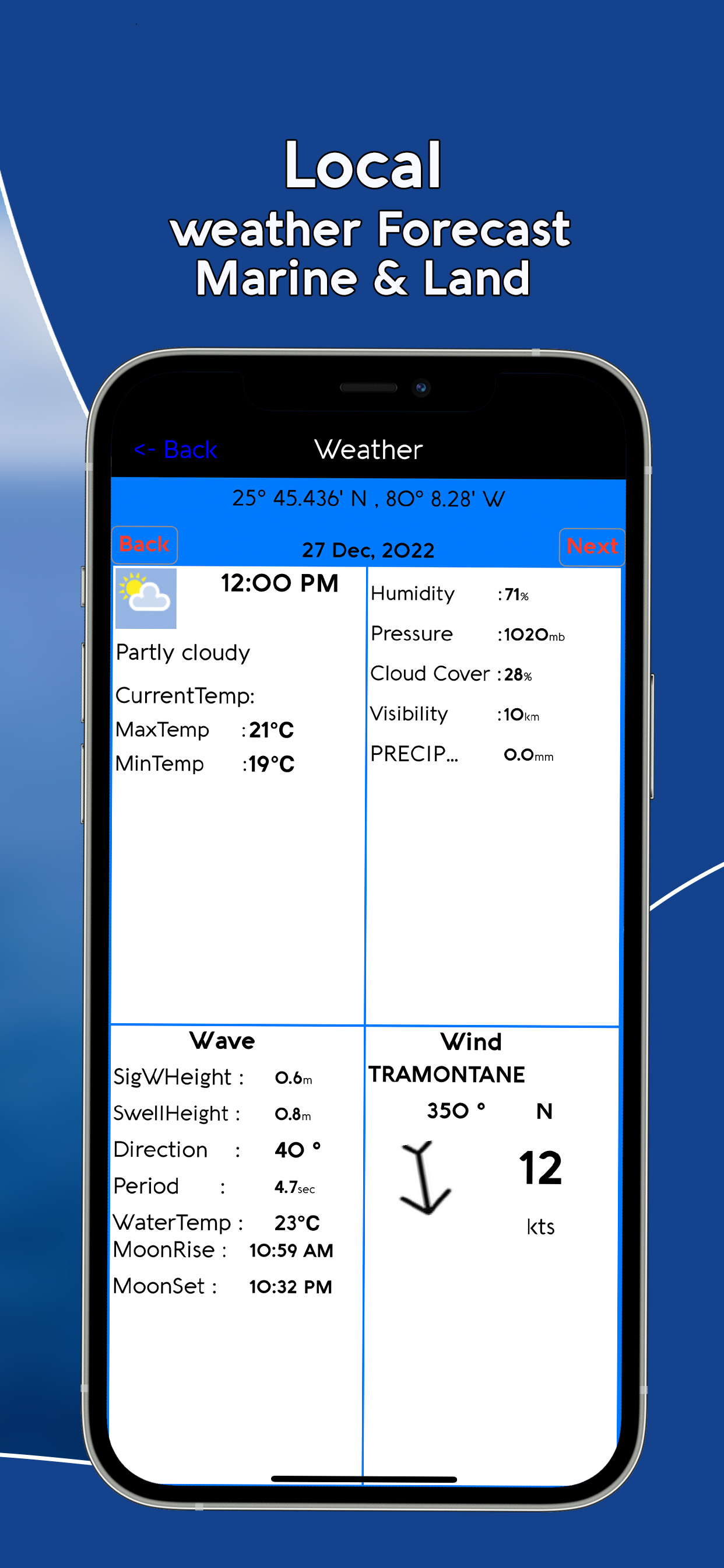
Local marine weather forecasts at your fingertips
Marine Maps:
Explore detailed Electronic Nautical Charts (ENC) with information on coastline, anchoring areas, fishing spots, restricted areas, obstructions, rocks, buoys, beacons, lights, depth contours, spot soundings, and more.
Lake Maps:
Access high-quality lake maps featuring depth contours, boat ramps, fishing spots, trails, roads, and railways information.
Park Maps:
Discover advanced electronic charts with hiking, biking, and equestrian trails, as well as points of interest like campgrounds, visitor centers, lookout points, eateries, ranger stations, picnic areas, boat/canoe ramps, parking areas, etc.
Travel Maps:
Explore the most captivating tourist areas, combining sea and land information for a comprehensive travel experience.
Stay connected with us:
Twitter: @flytomap
Web: flytomap.com
Facebook: facebook.com/flytomap
Embark on a journey of exploration and navigation like never before with AIS Maps: Marine and Lakes Charts by FlyToMap.
Hide..
Show more..
Unlock the full potential of FlyToMap with our in-app purchase business model, providing access to a comprehensive array of maps, including Marine, Travel, Parks, and Lakes. All these maps are available for offline use at reasonable costs.
Key Features:
Live AIS:
Experience real-time map views of your boat and nearby vessels worldwide without the need for an AIS receiver—just your mobile device. Various icons denote different vessel categories, and selecting a target reveals detailed information such as name, MMSI, IMO, call sign, status, speed, heading, coordinates, distance from your GPS location, and more.
Free Features and Functions:
Latitudes and Longitudes for easy navigation
Direct search for your favorite points
Intuitive zoom, rotate, and pan with a touch
Quick object information with vector technology
GPS heading for precise navigation
Distance measurement tool for easy calculations
Route planning with real-time speed, distance, and bearing updates
Magnifying lens for detailed information
Unlimited tracks, markers, geo-tagged photos, and records
Shareable via email and visible on Google, Flytomap Viewer, and KMZ format
Depth contours selection
Background functionality for multitasking
Optimized battery usage
Local marine weather forecasts at your fingertips
Marine Maps:
Explore detailed Electronic Nautical Charts (ENC) with information on coastline, anchoring areas, fishing spots, restricted areas, obstructions, rocks, buoys, beacons, lights, depth contours, spot soundings, and more.
Lake Maps:
Access high-quality lake maps featuring depth contours, boat ramps, fishing spots, trails, roads, and railways information.
Park Maps:
Discover advanced electronic charts with hiking, biking, and equestrian trails, as well as points of interest like campgrounds, visitor centers, lookout points, eateries, ranger stations, picnic areas, boat/canoe ramps, parking areas, etc.
Travel Maps:
Explore the most captivating tourist areas, combining sea and land information for a comprehensive travel experience.
Stay connected with us:
Twitter: @flytomap
Web: flytomap.com
Facebook: facebook.com/flytomap
Embark on a journey of exploration and navigation like never before with AIS Maps: Marine and Lakes Charts by FlyToMap.
In-Apps
- Bali HD
- Rp 49ribu
- Foggy cape
- Rp 69ribu
- Fox Islands
- Rp 69ribu
- Singapore HD
- Rp 49ribu
- Flytomap Pro HD
- Rp 99ribu
- Sheuk of Strait
- Rp 69ribu
- Pribil of islands
- Rp 69ribu
- East Kodiak Island
- Rp 69ribu
- East Andrean of Islands
- Rp 69ribu
- Boating Australia HD Charts
- Rp 199ribu
Screenshots


User Rating
5 out of 5
1 ratings in Indonesia
5 star
1
4 star
0
3 star
0
2 star
0
1 star
0
Ratings History
AIS Maps Installs
Last 30 days
AIS Maps Revenue
Last 30 daysAIS Maps Reviews
Store Rankings
Ranking History
Category Rankings
|
Chart
|
Category
|
Rank
|
|---|---|---|
|
Top Grossing
|

|
33
|
|
Top Grossing
|

|
66
|
|
Top Grossing
|
|
99
|
|
Top Free
|
|
111
|
|
Top Free
|
|
133
|
Keywords
AIS Maps Competitors
| Name | Reviews | Recent release | |
|---|---|---|---|

i-Boating: Marine Charts & Gps
Lake Maps & Fishing Spots
|
0
|
1 week ago | |

Atlas Nautical Charts
Marine & Lakes GPS Charts
|
0
|
1 year ago | |

PRO CHARTS - Marine Navigation
|
6
|
11 months ago | |

Aqua Map Boating
Marine navigation and fishing
|
0
|
1 month ago | |

NV Charts GPS Navigation AIS
Marine Navigation and Boating
|
0
|
3 months ago | |

WinGPS Marine
|
0
|
2 weeks ago | |

SeaNav
Marine Charts and Navigation
|
0
|
3 months ago | |
Marine Navigation Lite
Offline GPS tracker for boat
|
0
|
6 months ago | |

iAIS
|
0
|
2 years ago | |

OnCourse - boating & sailing
Navigation - mAIS
|
0
|
5 months ago |
AIS Maps Revenue and Downloads
Gain valuable insights into AIS Maps performance with our analytics.
Sign up now to access downloads, revenue, and more.
Sign up now to access downloads, revenue, and more.
App Info
- Category
- Navigation
- Publisher
- Flytomap
- Languages
- English, French, German, Italian, Portuguese, Spanish
- Recent version
- 6.4.3 (3 months ago )
- Released on
- Aug 1, 2012 (12 years ago )
- Also available in
- United States, Italy, Germany, Australia, France, Spain, United Kingdom, Turkey, Switzerland, Canada, Vietnam, Russia, Norway, Greece, Peru, India, Ireland, Indonesia, South Korea, Thailand, Brazil, United Arab Emirates, New Zealand, Malaysia, Netherlands, Nigeria, South Africa, Philippines, Pakistan, Poland, Portugal, Romania, Saudi Arabia, Sweden, Singapore, Taiwan, Ukraine, Algeria, Argentina, Austria, Azerbaijan, Belgium, Belarus, Chile, China, Colombia, Czechia, Dominican Republic, Mexico, Ecuador, Egypt, Finland, Hong Kong, Hungary, Israel, Japan, Kuwait, Kazakhstan, Lebanon
- Last updated
- 2 days ago