Avenza Maps: Offline Mapping

GPS, Trails, Hiking, Offroad

Published by: Avenza Systems

Description

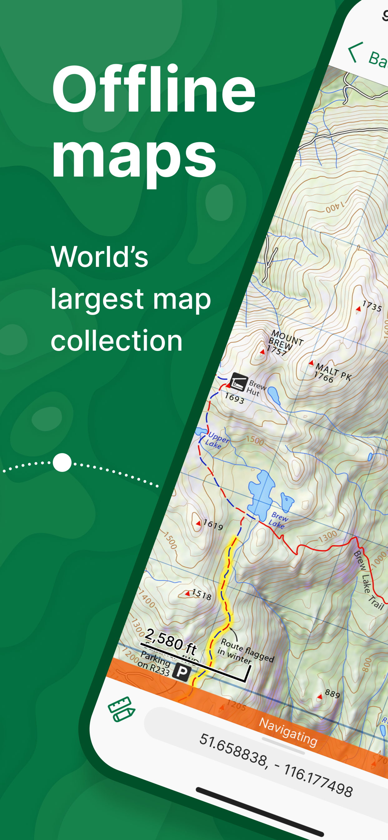
Avenza Maps, #1 app for hiking, biking and all trails. Featuring maps from National Geographic, national parks and more!
On your next adventure, stay on track with GPS using offline mobile maps. Make your own maps? Import your custom maps and never get lost off the grid.
Explore the largest mobile Map Store of hiking, topographic, cycling, city, nautical, travel, and trail maps. Featuring maps from professional publishers including National Geographic, National Park Service, and the US Forest Service. Discover maps for your next camping, fishing, or backpacking trip with your family and friends. Navigate confidently when off-roading or taking those backcountry trails. Precisely identify your location with what3words and stay safe wherever you are.
Avenza Maps is free and the best map app for recreational use. Maps are available for free or purchase from the in-app Map Store. Plus subscription is available for unlimited custom map imports. Pro subscription is available for professional users with full access to all features and mapping tools.
Avenza Maps for your offline adventures on all trails!
ENHANCE YOUR MAPS WITH THESE FEATURES
- Locate your realtime GPS position and find direction, even when offline
- Record GPS tracks during your activities
- Navigate to features using compass tools
- Add photos and notes to any location
- Add placemarks to your map and style them with recreational symbols
- Measure distances and estimate times
- Supports KML, GPX, and CSV Formats
EXPLORE THE MAP STORE
Search and download maps by activity, category, and specific publishers with premium maps from:
- National Geographic
- Michelin
- Backroad Mapbooks (BRMB)
- New York - New Jersey Trail Conference
- USFS (United States Forest Service)
- USGS (United States Geological Survey)
- FAA (Federal Aviation Administration)
- NOAA (National Oceanic and Atmospheric Administration)
- BLM (Bureau of Land Management)
- HarperCollins
- DeLorme Atlas & Gazetteer / Garmin
- BaseImage
- National Park Service
- And thousands more!
A free account lets you access all of your map downloads.
GET MORE WITH AVENZA MAPS PLUS
For recreational and power users who need more
- Unlimited import of your own geospatial PDF, GeoPDF®, and GeoTIFF maps
- Create geofences for up to 50 individual features and up to four geofence layers
GET EVEN MORE WITH AVENZA MAPS PRO
For professionals and organizations who require an offline mapping solution with location awareness with more features and tools
- Unlimited import of your own geospatial PDF, GeoPDF®, and GeoTIFF maps
- GPS averaging, additional coordinate display formats, custom symbol sets
- Connect high-accuracy GPS devices including Trimble, Bad Elf, and Dual via Bluetooth
- Created unlimited geofences and get global geofence notifications
- Convert tracks to areas
- Map orientation lock
- Import and export Esri® Shapefiles
- Import and manage custom symbology sets
- Priority technical support
Avenza Maps Pro subscription required for commercial, academic, government, and professional use.
Avenza Maps Plus and Pro are available as annual subscriptions. You can subscribe and pay through your Apple ID. Subscriptions are 12 months in duration and will automatically renew unless auto-renew is turned off at least 24 hours before the end of the current period. Your account will be charged within 24 hours prior to the end of the current period at the rate of your selected plan. Auto-renewal can be turned off in your iTunes Account Settings. If you didn’t use iTunes to subscribe, you can manage your subscription through Avenza.
SUPPORT
We can help! Go to support.avenzamaps.com
LEGAL
Privacy Policy: avenzamaps.com/legal/privacy-policy.html
Terms of Use: avenzamaps.com/legal/terms.html
CONNECT WITH US
avenzamaps.com
facebook.com/avenzamaps
twitter.com/avenzamaps
instagram.com/avenzamaps
Show More...

In-Apps

Anavasi Editions Map Product
€7.99
Anavasi editions Tier 10
€9.99
Geopsis Product
€7.99
Geopsis Tier 5
€5.99
Geopsis Tier 8
€8.99
TERAIN ΧΑΡΤΟΓΡΑΦΙΚΗ ΙΚΕ Tier 8
€8.99
ROUTE maps Tier 9
€9.99
Avenza Maps Plus
€39.99
Geopsis Tier 3
€2.99
Geopsis Maps & Guides Tier 10
€9.99
Geopsis Tier 1
€0.99
Terrain Editions Tier 5
€5.99

Screenshots

Avenza Maps FAQ

  • Is Avenza Maps free?

    Yes, Avenza Maps is free to download, however it contains in-app purchases or subscription offerings.

  • Is Avenza Maps legit?

    🤔 The Avenza Maps app's quality is mixed. Some users are satisfied, while others report issues. Consider reading individual reviews for more context.

  • How much does Avenza Maps cost?

    Avenza Maps has several in-app purchases/subscriptions, the average in-app price is €9.99.

  • What is Avenza Maps revenue?

    To get estimated revenue of Avenza Maps app and other AppStore insights you can sign up to AppTail Mobile Analytics Platform.

User Rating

4.79 out of 5

247 ratings in Greece

5 star
202
4 star
39
3 star
6
2 star
0
1 star
0
Ratings History

Avenza Maps Reviews

Samos island paths by Terrain:

Guy de Nivelet on

Greece

My review is for the map, not the app. The map nicely shows a collection of walking trails on the mountains of Samos. However, the map is just an image background with a rather low resolution. The map focuses on marked walking trails. The exact position of these paths (and crossings etc) is not shown due to the map resolution. Routing is not possible. Therefore one has to partially rediscover the trail while walking. Terrain should try to create real digital vector maps from their original data.

Πολύ χρήσιμη

nkail30 on

Greece

Μπορείς πλέον να εντοπιστείς στον χάρτη ακόμη και χωρίς 4g Για τα σημεία που πιάνει το κινητό είναι η εφαρμογή δίνει εξαιρετική βοήθεια

OHV Lead

cluncky on

United States

Perfect for Search and Rescue

Print options?

Connie Loffswold on

United States

I would give it a higher rating if you could print your maps

App not working

Dingo150 on

United States

I can’t down load maps or preview them. Used this app a couple years ago and it was great but now nothing works.

Good app

CedarSlayer3 on

United States

I’ve been using this app for years every day for work and it’s always been spot on

Just a touch more?

Pscansetzer on

United States

Great app. Used it a lot in the Big Horn National Forest. Would like to see a function to record notes on the tracking function. Thanks for a great app!

Map Review

Big Bo’s W on

United States

Maps are easy to read. High quality. And best of all, you can map out your ride trail-to-trail. No other map can do that, that I’ve tried. Once ride is mapped out, you have distance traveling, which helps with planning destinations. It’s easy to follow and tracks your ride.

Terrible app

Capt.Ballyhoo on

United States

Florida wildlife makes you use this app to know your boundaries for hunting. Which makes sense that the government is involved. This is the worst app I’ve ever used. Absolute garbage.

The best

buryitz on

United States

Tried them all and the only one we use now for trail riding.

Store Rankings

Ranking History
Category Rankings
Chart
Category
Rank
Top Free
7
Top Grossing
8
Top Grossing
13
Top Grossing
14
Top Grossing
15

Keywords

Avenza Maps Competitors

Avenza Maps Installs

Last 30 days

Avenza Maps Revenue

Last 30 days

Avenza Maps Revenue and Downloads

Gain valuable insights into Avenza Maps performance with our analytics.
Sign up now to access downloads, revenue, and more.
This page includes copyrighted content from third parties, shared solely for commentary and research in accordance with fair use under applicable copyright laws. All trademarks, including product, service, and company names or logos, remain the property of their respective owners. Their use here falls under nominative fair use as outlined by trademark laws and does not suggest any affiliation with or endorsement by the trademark holders.