GPX viewer
The paper map reinvented
#1 Keyword Rankings
Today
Top 10 Rankings
Today
Top 30 Rankings
Today
Top 100 Rankings
Today

Description

Import your routes in GPX format (tracks or routes) into the application.

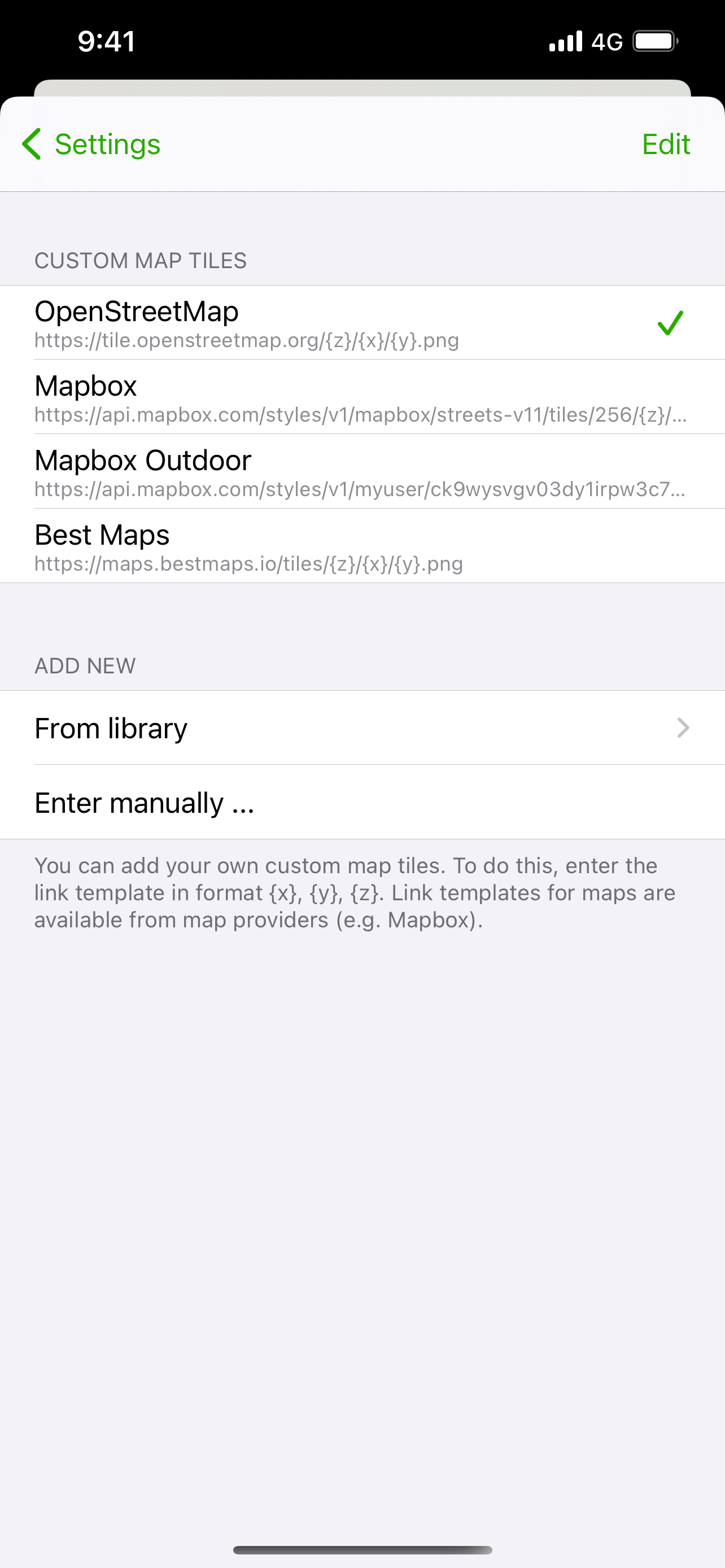
Display them on different preset maps (plan, satellite, OpenStreetMap, OpenTopoMap, Swisstopo, IGN) or on your own custom maps.

Display an elevation graph to evaluate their difficulty. And check out all of their information.

Follow your position along the route during your ride. You can also display points of interest from GPX.

All what you need to go hiking and follow your route. All for free and without ads. The only in-app purchases are tips for few other features, take a look.

Features details:
- Import of GPX files via file or web link
- Management of imported GPX (library)
- Display GPX track on the map (track and route)
- Several base maps: map, hybrid, satellite 3D, OpenStreetMap, OpenTopoMap, Swisstopo
- Possibility to set your own custom maps from a library or manually
- Possibility to download maps for offline use
- Displayed on the map: current position, start and end of the route, points of interest along the route, scale, route direction
- Choice of color and size of the route
- Locking of screen standby to better follow the route
- Map cache system
- Display of GPX details: name, description, longitudinal profile, elevation differences, distance, image gallery, link, points of interest
- Display details of a point of interest: name, description, image gallery, links
- Access to the route via Maps, Google Maps or Waze
- Sharing a GPX
- GPX editor
- Speedometer

Note: If the application cannot open a GPX file, contact me by sending me the file.
Hide.. Show more..

In-Apps

A burger
CHF 8.00
A coffee
CHF 4.00
Hiking equipment
CHF 20.00

Screenshots

User Rating

4.81 out of 5

16 ratings in Switzerland

5 star
15
4 star
0
3 star
0
2 star
1
1 star
0

Ratings History

Reviews

top!!!!

friscotunes on

application simple et complète. importation des parcours (fichiers gpx) facile. version gratuite san pub…. merci. et j’apprecie là passage à la version pro avec ces "propositions" de payement… drôle et convainquant… du coup j’ai payé le maximum. 😊 encore bravo 😊

Gute App für GPX Dateien

Dk1403 on

Diese App ist eine der wenigen die GPX Dateien importieren kann. Man kann damit gut auf Wanderwegen navigieren.

Simple and to the point

Golombola on

This is a very simple app that does what it needs to do and not more: load a GPX file and show your location so you can follow your route. It’s a welcome reprieve from all the performance focused apps like strava and let’s you focus on what’s essential: being out there. The fact that it also doesn’t collect any data makes this a winner in my book. Pro version is also well worth it!

Super application pour trail

aldxander coconut on

Je l’utilise régulièrement pour mes sorties trails en complément de ma montre gps. Cela me permet de facilement et rapidement avoir une vue d’ensemble sur le parcours. (En offline aussi) L’importation du fichier GPX par l’intermédiaire d’une url et vraiment top. Il me suffit de copier le lien de l’itinéraire GPX souvent mis à disposition sur les sites des courses et de le coller. Idée : j’essai souvent de comparer certaines portions de mes parcours pour me repérer sur le terrain. Ça me serait bien utile de pouvoir afficher simultanément plusieurs tracés😄 Merci

Easy hiking

airlineinfo on

On holiday in the mountains, the local tourist office offered hiking route suggestions, with GPX downloads. I had no experience with the format, and was overwhelmed with the choice of apps that were either full of ads or limited in functionality, unless you buy the premium version. I was so happy to find this one, great concept to offer the full version for free, and make payments voluntary. The app got us safely up and down the mountains, also worked perfectly in regions of low to no network coverage!

Store Rankings

Ranking History

Category Rankings

Chart
Category
Rank
Top Free
22
Top Free
44
Top Free
44
Top Grossing
49
Top Grossing
51

Keywords

Users may also like

Name
Iphigénie | The Hiking Map App
IGN maps, hiking, outdoor
GPS Tracks
GPS Tracker and Offline Maps
Wikiloc Navigation Outdoor GPS
Eine Welt zu erkunden
Topo GPS - Topographic maps
Topografische Karten
OsmAnd Maps Reise & Navigation
Offline-Karten für die Reise
Visorando – Wanderideen
Wander-GPS mit Offline-Modus
Open GPX Tracker
No ads, no in-app purchases
Geovelo: Fahrrad GPS
Fahrrad-Navigation per GPS
IGNrando' – France hiking maps
Hiking & cycling with IGN maps
Fietsknoop Rad und Wander App
Rad und Wander Knotenpunkten.
Show More

Revenue and Downloads

Gain valuable insights into GPX viewer performance with our analytics. Sign up now to access downloads, revenue, and more.

App Info

Category
Navigation
Publisher
Jonathan Gander
Languages
English, French
Recent version
1.3.10 (9 months ago )
Released on
May 6, 2020 (4 years ago )
Last updated
4 hours ago