MapOut

Beautiful hiking & cycling map

Разработчик: Valnova
Скачивания
Доход

Описание

“MapOut saves the day by using a simple interface to draw routes, and check out elevation profiles… I’m pretty blown away by its capabilities.” – Alee from cyclingabout.com
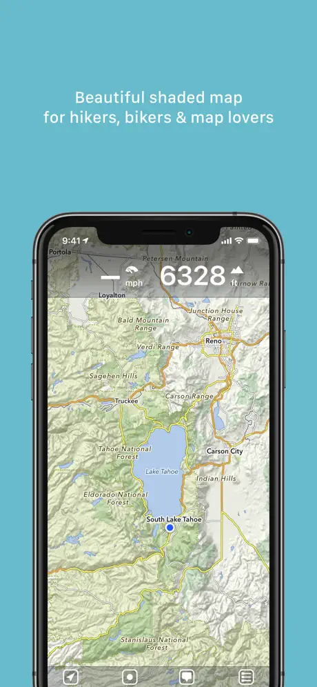
Offline map covering the whole world for iPhone and iPad. Almost as beautiful as a paper map - only more versatile.
- For hikers: With an easy-to-read representation of the terrain, even in the furthest corners without internet
- For cyclists: With cycling route network, speed and distance display
- For city travelers: City maps with tourist information
- For the connoisseur: Simply beautiful map to look at
3D tilt view
- Tilt the device in any direction to get a better impression of the terrain. More information on https://mapout.app.
Search feature
- Search for places, streets, mountains, etc. No internet connection required.
Map material
- MapOut is based on the OpenStreetMap project, the “Wikipedia of Maps” - you can make corrections and additions yourself on OpenStreetMap.org. The latest maps are delivered with periodic updates.
- Download the regions of your choice - the maps can now be displayed without an internet connection (offline map).
Tours
- Drawing: Draw your own routes and waypoints directly on the map. Retouch existing tours and imported GPX files or let them directly snap to the road network.
- Import: With a free “MapOut.me” account you can send directions by email to your device. GPS-Tours can be found as gpx or kml files on many websites with tips for hiking or biking (e.g. on www.gpsies.com)
Record: Take recordings of your own tours and share them with friends.
Information: Quick overview of each tour - length, altitude change, map section and route profile
Map view
- Fast map display (hardware accelerated)
- Step-free zoom, always a pixel-perfect map
- Topographical map with contour lines and shading
- Selectable overlays: Bike/hike/ski routes, sightseeing, public transport
Find all answers to your questions in our user manual: https://mapout.app/manual
Map data © OpenStreetMap contributors (https://www.openstreetmap.org/copyright)
Hide Показать больше...

Скриншоты

MapOut Частые Вопросы

  • Приложение MapOut бесплатное?

    MapOut не является бесплатным (стоимость составляет 7.99), однако оно не содержит встроенных покупок или подписок.

  • Является ли MapOut фейковым или мошенническим?

    ✅ Приложение MapOut кажется качественным и надежным. Пользователи очень довольны.

    Спасибо за ваш голос

  • Сколько стоит MapOut?

    Цена MapOut составляет 7.99.

  • Сколько зарабатывает MapOut?

    Чтобы получить оценку дохода приложения MapOut и другие данные AppStore, вы можете зарегистрироваться на платформе мобильной аналитики AppTail.

Оценки пользователей

4.56 из 5

59 оценок в Австралия

5 star
45
4 star
7
3 star
2
2 star
1
1 star
3
История оценок

MapOut Отзывы Пользователей

простые и удобные топо-карты

some.hren on

Россия

оффлайн без покупок, удобная работа с треками, батарейку не ест особо, в целом вполне приятное. из минусов: трек в background периодически отключается и не возобновляется сам; при пробуждении телефона радостно говорит «о, gps-signal is good again” и снова включает запись — а в треке дырка.

Best hiking app I’ve seen

legkohod on

Россия

Лучшее походное приложение. Простое и удобное. Regards from Russia

Evgeniy

Samson78 on

Россия

Очень хорошо!!!

Best App for Creating bike routes

Shogun Trailbraker on

Австралия

Highly recommend this app! I use it to draw routes for bike rides and couldn’t be happier with the offline capabilities. Only thing i wish it had was turn by turn navigation.

Sensational

bobathy brown on

Австралия

I've been using this app through my outdoor proffesional work and it has been nothing but short of amazing, insanely useful and i love how simple and smooth everything works the only downside is it often doesn't have all campsites marked and i have to refer to a physical map but aside from that small issue i obsess over this app

The best mapping and planning app

Fgtrsxcnjhg983 on

Австралия

I use this all the time on my biking tours. Works great offline.

SPLITSCREEN !!!

Oziroads on

Австралия

How much longer do we have to wait for split screen for ipad users, come on guys get on with it please. This is one of the few map apps that doesn’t do splitscreen, this function would make it so much more useful and desirable for us 4wdrivers. Developers ,PLEASE CONSIDER.

Good app for getting a quick sense of the landscape

Sinornithosaurus on

Австралия

Nice looking hill shading, with decent graphics for quick identification of mountains, tracks and general geography. The hill shading is a bit too strong, so sometimes you zoom in to a feature only to find out it’s actually a pretty flat landscape (Australian here). It would also be cool to see some expanded features in the future; Contours and cliff edges only appear at an extremely zoomed in view, it’d be useful to see those features at more zoomed out levels. On that note, a colour-based height overlay would be helpful, so we can quickly and easily see elevation without too much effort.

Fantastic

Fayley on

Австралия

I recommend this to all hikers, bikepackers, packrafters, and kayakers. It has a great way of organizing and visualising all your tracks and waymarks, as well as hiding or seeing them based on what “tour” you assigned them to. The visualisation and ease of use is great, especially the way mark symbols and colours. Fantastic. Note to developers: please add a “bridge” Waymark icon - particularly good for planning kayaking and packrafting trips

Minimalist and works great!

whatareliefmaps on

Австралия

Really happy with this app! Have just come back from hiking in the Australian Alps and needed an app which had offline capability and could import GPX files and used this the entire time and it made things very easy! The Good: - Minimalist design - Uses very little battery (I have a useless iPhone 8 battery and on airplane mode it would only use ~10% over the course of the day. - Loved the ease of the point to point distance tracker The Bad: - The 3D tilt perspective seems a bit redundant and looks warped and weird especially with the hill shading - The GPX import feature is a touch awkward, if possible an ‘import’ button which lets you browse your phone for files, rather than navigating to the file first and opening it in Map Out may be easier - As others have said I would love support for additional/ custom map tiles, the OSM tiles are good but often need to be very zoomed in to access relevant data - I would love it if the notes against the waypoints I set would appear in the box when I select them On the whole this app works very well at what it is designed to be: easy to use, minimalist design, functional and without all the bells and whistle and I would much rather pay upfront than suffer through in-app purchases and expensive monthly subscription fees.

Оценки

История позиций в топах
Позиции в категории
Рейтинг
Категория
Позиция
Топ платных
2
Топ платных
2
Топ платных
2
Топ платных
3
Топ платных
5

Ключевые слова

MapOut Конкуренты

Name
PeakFinder
The mountains are calling!
Maps 3D PRO - Outdoor GPS
GPS for Bike, Hike & Ski
Pocket Earth PRO
Offline Maps & Travel Guides
SwitzerlandMobility
Non-motorized traffic network
swisstopo
Official Swiss Maps
Warmshowers App
Swiss3D
Peak detection
SAC – Swiss Alpine Club
Mountain tours, huts & more
Swiss Pro Map
Maps for Switzerland and Alps
Rother: Hiking & Bike
The best hikes.

MapOut Установки

Last 30 days

MapOut Доход

Last 30 days

MapOut Доходы и Загрузки

Получите ценные инсайты о производительности MapOut с помощью нашей аналитики.
Зарегистрируйтесь сейчас, чтобы получить доступ к статистика загрузок и доходов и многому другому.

Информация о приложении