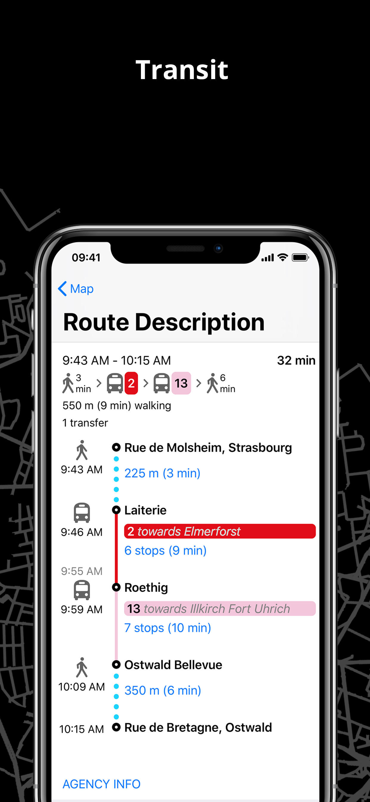
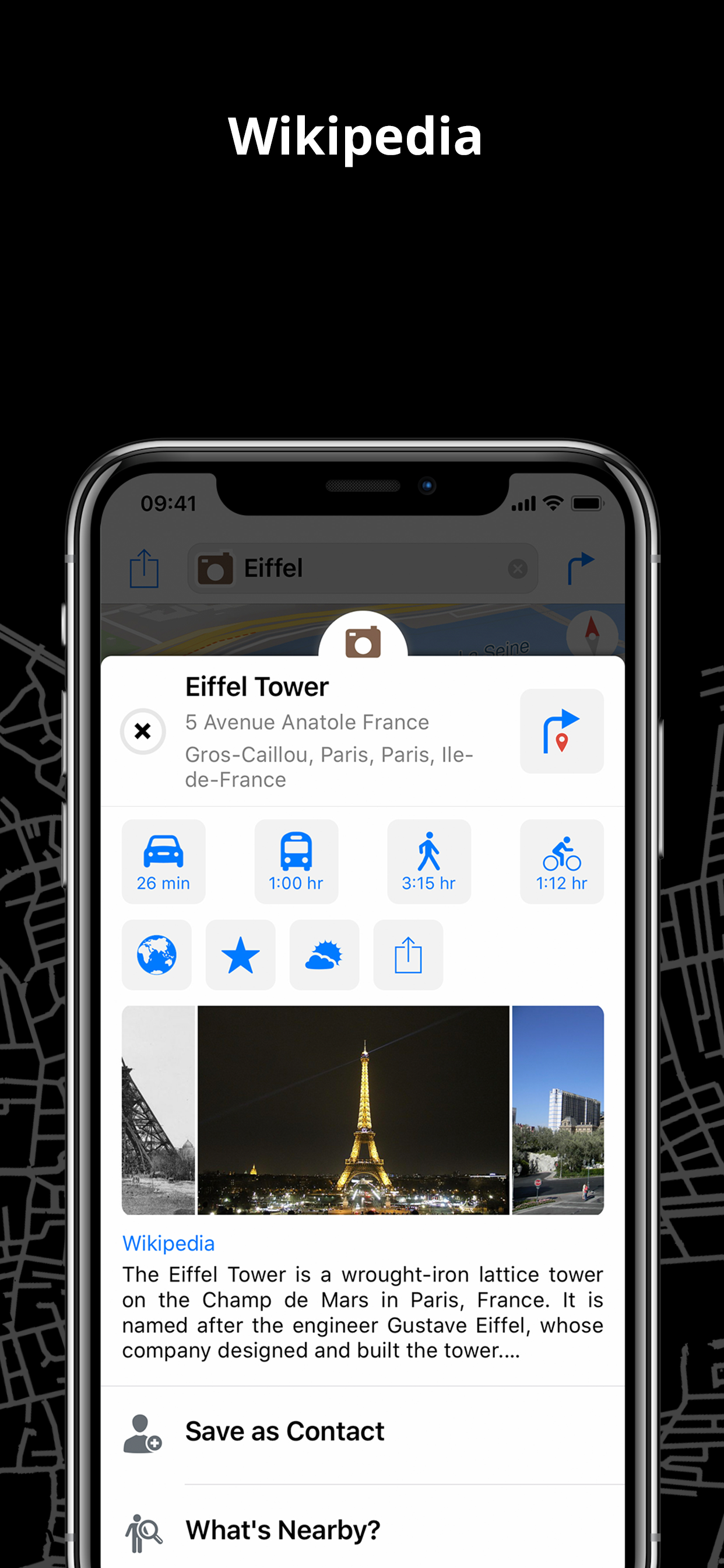
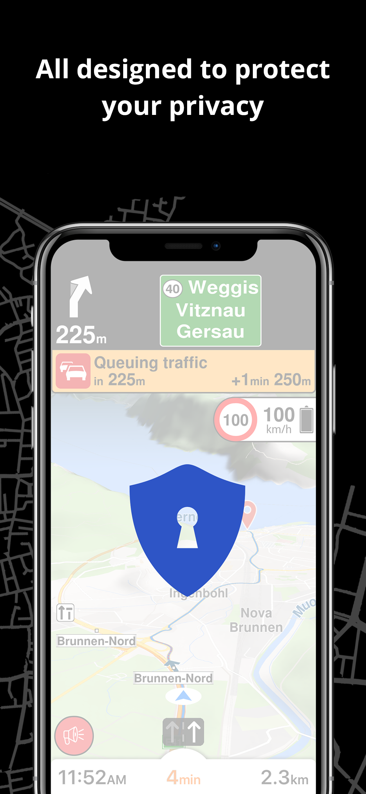
Best of all
I SAID IT IN THE PAST AND I SAY IT AGAIN “YOU ARE THE BEST NAVIGATION OF ALL OTHERS”


Yes, Magic Earth Navigation & Maps is completely free and it doesn't have any in-app purchases or subscriptions.
🤔 The Magic Earth Navigation & Maps app's quality is mixed. Some users are satisfied, while others report issues. Consider reading individual reviews for more context.
Magic Earth Navigation & Maps is free.
To get estimated revenue of Magic Earth Navigation & Maps app and other AppStore insights you can sign up to AppTail Mobile Analytics Platform.

4.47 out of 5
15 ratings in Greece
I SAID IT IN THE PAST AND I SAY IT AGAIN “YOU ARE THE BEST NAVIGATION OF ALL OTHERS”
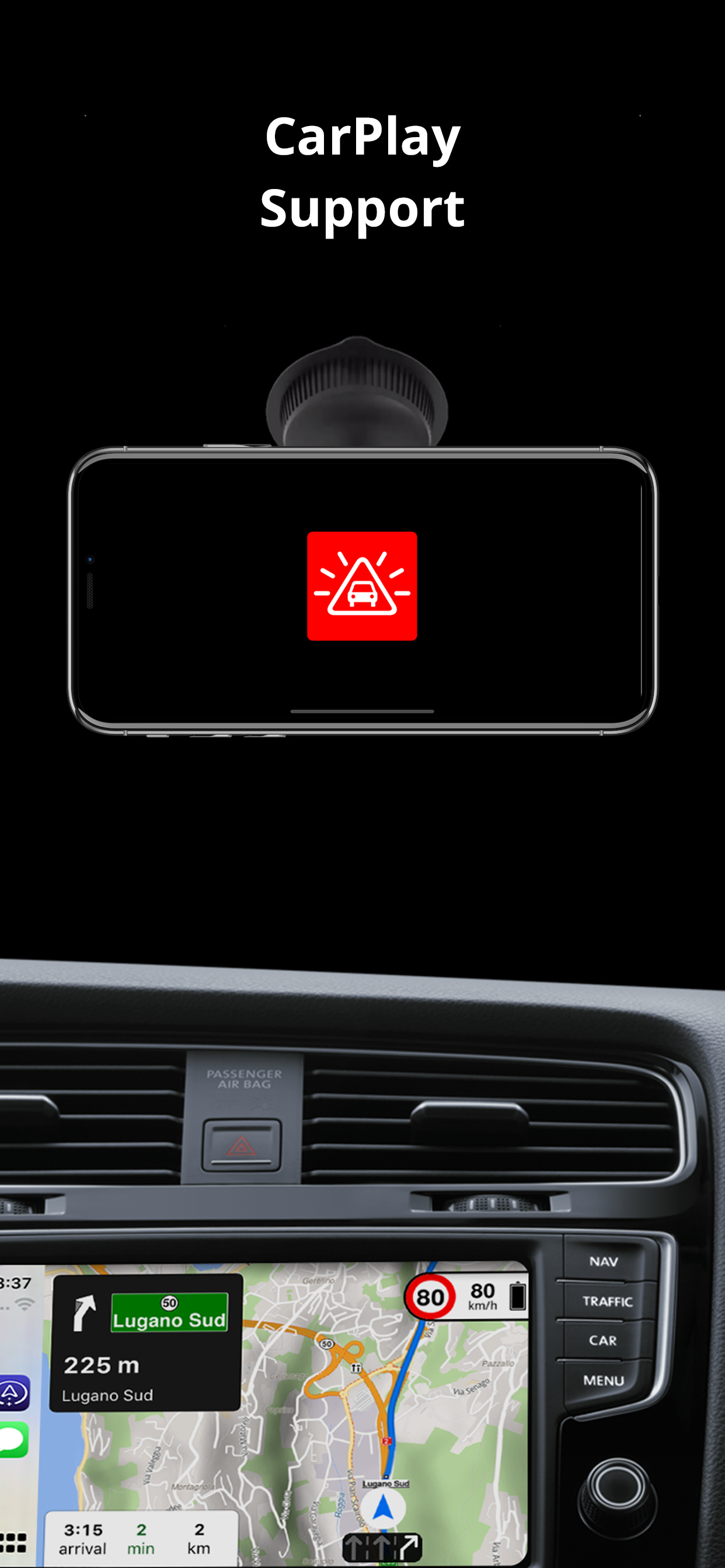
It’s a great navigation app and the most fair navigation app I ever have. I pay so little money all the updates of my apps are coming. I can use it in my car CarPlay and all that without paying nothing extra. It is the most fair app, very much value for very little money I am very grateful
Ο χάρτης Ελλάδας δεν έχει λεπτομέρειες σε πάρα πολλές περιοχές. Δηλαδή, δεν λείπουν οι περιοχές αλλά δεν αναγράφονται οι οδοί...
The app said safety lens not enabled how can I fix it????
Εφόσον δεν εισασταν έτοιμοι γιατι το κάνατε; Παρακαλω δώστε μας πισω το πληρωμένο και άψογο Route66!!! Επίσης μετα και την σημερινή αναβάθμιση (16/08/2016) συνεχίζει το πρόβλημα όσον αναφορά την ανύπαρκτη αρίθμηση των οδών σε κάποιες περιοχές.
Καλή η εφαρμογή,δωρεάν αλλά οι χάρτες των μεγάλων χωρών κατεβαίνουν ολόκληρη και όχι κατά διαμερίσματα ή κατα νομούς,περιοχές κλπ
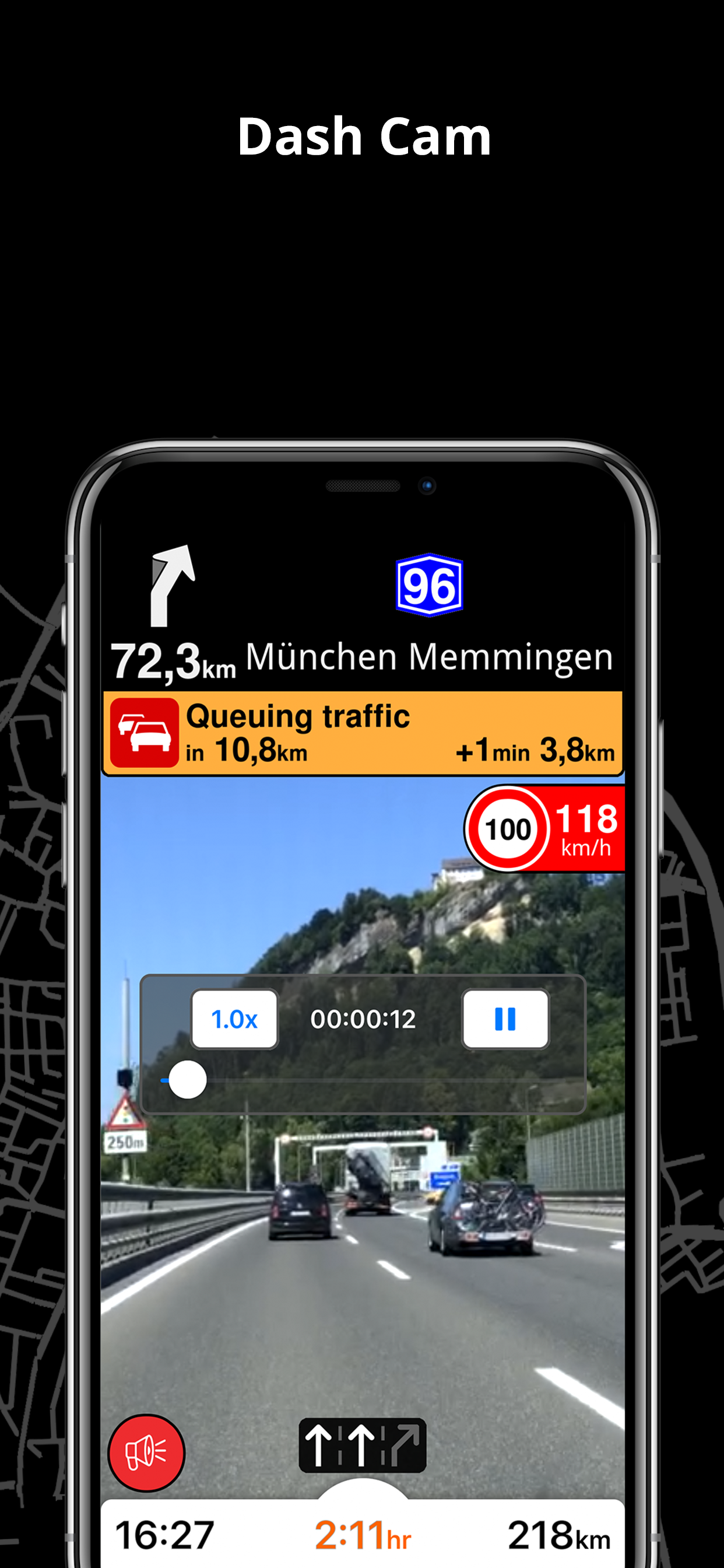
In dieser App ist einfach alles enthalten was man benötigt auch super für campervans da man in den Einstellungen einen lkw angeben kann mit Gewicht höhenmaß Länge etc. Oft ist diese Funktion bei anderen Apps kostenpflichtig ab 60-80€. Ich wollte einmal Danke sagen an das ganze Team das diese großartige App entwickelt am laufen hält und aktualisiert. Ich nutze die App seit Jahren und bin mehr als zufrieden. Top Produkt !
Es gibt nur noch eine Ansage, dass ich die Stationen überprüfen soll. Navigieren geht nicht mehr. Sehr schade, denn bis dahin lief am iPhone 11 pro alles einwandfrei. Bis dahin beste Wohnmobil Navi App
Ich benutze seit langen die App und gefällt mir auch im großen und ganzen. Allerdings habe ich festgestellt das derzeit wohl Probleme sind da ich bei Eingabe der Adresse sowie Favoriten Adresse die Aussage bekomme das ich Stationen überprüfen soll und somit kein Erfolg fürs navigieren habe Bitte diese überprüfen und beseitigen das ich weiterhin die App benutzen kann
Die App ist überraschend gut, doch es gibt einen kritischen Punkt, der dringend verbessert werden muss: die teils verspäteten Ansagen zum Abbiegen. Trotz präzisem GPS kommen diese Anweisungen oft erst im Kreuzungsbereich, was sehr gefährlich sein kann, wenn man dann abrupt das Lenkrad herumreißt. Aus diesem Grund vergebe ich nur 3 Sterne.
|
Chart
|
Category
|
Rank
|
|---|---|---|
|
Top Free
|

|
88
|
|
Top Free
|

|
105
|
|
Top Free
|

|
138
|
|
Top Free
|

|
140
|
|
Top Free
|

|
143
|
| Name | Downloads (30d) | Monthly Revenue | Reviews | Ratings | Recent release | |
|---|---|---|---|---|---|---|
|
CoPilot GPS Sat-Nav & Traffic
GPS for Car, Caravan and Truck
|
Unlock
|
Unlock
|
20
|
|
2 weeks ago | |

Sygic GPS Navigation & Maps
Offline maps, Sat Nav, CarPlay
|
Unlock
|
Unlock
|
36
|
17
|
1 week ago | |

TomTom GO: Navigation, Maps
Satnav, GPS, Traffic & CarPlay
|
Unlock
|
Unlock
|
24
|
3
|
1 month ago | |

OsmAnd Maps Travel & Navigate
Top-rated mobile trip planner
|
Unlock
|
Unlock
|
4
|
1
|
2 days ago | |

HERE WeGo Maps & Navigation
Enjoy the journey
|
Unlock
|
Unlock
|
26
|
1
|
2 weeks ago | |

Sygic GPS Truck & Caravan
HGV Sat Nav, Maps & CarPlay
|
Unlock
|
Unlock
|
1
|
2
|
3 days ago | |

Karta GPS - Offline Maps Nav
Sat Navigation & Live Traffic
|
Unlock
|
Unlock
|
20
|
|
3 months ago | |

MapFactor Navigator - GPS Maps
Offline navigation for all
|
Unlock
|
Unlock
|
0
|
1
|
9 months ago | |

TomTom AmiGO GPS Maps, Traffic
Navigation & Speed Camera
|
Unlock
|
Unlock
|
0
|
1
|
3 weeks ago | |

Organic Maps: GPS navigation
Walking trails, cycling routes
|
Unlock
|
Unlock
|
0
|
|
3 weeks ago |

