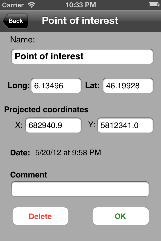
Do you have maps that you would like to use offline on your iPhone/iPad with GPS positioning? Discover Multiplans, a powerful map application in which you can import your maps (whatever their source) and view them offline with a great multitouch experience and pinpoint accurate GPS positioning. Multiplans can moreover record tracks and save points of interests.
Multiplans has been designed to offer a great map viewing experience: simple uncluttered interface, map shown full screen (a single tap toggles on/off the display of overlay information), ultra-fast scrolling and zooming.
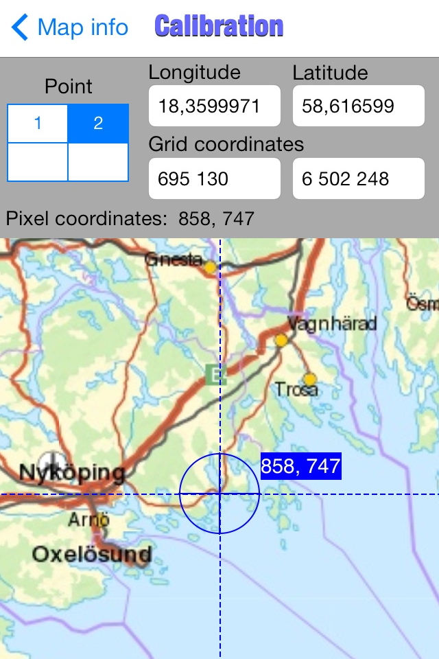
With Multiplans, you don't have to buy again maps that you already own, just to use them on your iPhone. No subscription either that will soon expire. To use a map on your iPhone/iPad, simply transfer the map image into Multiplans (with a .map or ref.txt calibration file if you have one). Maps can be also calibrated entirely within Multiplans by defining graphically calibration points on the map.
A few sample maps are provided with Multiplans: a world map, a map of Switzerland, etc. A few more maps can be downloaded free of charge from www.multiplans.net. Multiplans is compatible with almost all coordinate systems used in the world. To import your own maps into Multiplans and have accurate GPS positioning, the map needs to be calibrated (see www.multiplans.net). Maps from OpenStreetMap (for any region in the world), as well as maps from similar mapping web sites, can be imported into Multiplans very easily by using the free program mobile atlas creator.
Visit www.multiplans.net for more information.
IMPORTANT NOTES:
- Continued use of the GPS running in the background can dramatically reduce battery life on the iPhone or iPad.
- Multiplans' features, including map and location accuracy, should not be depended upon in situations where inaccuracies or errors could cause danger, commercial loss or any other problem. Though we did our best to make Multiplans an excellent app, it is provided as is with no warranty.
Hide..Show more..
Screenshots
User Rating
4 out of 5
1 ratings
in Australia
5 star
0
4 star
1
3 star
0
2 star
0
1 star
0
Ratings History
Reviews
Multiplans works!
Finally a mapping/gps app that uses Oziexplorer .map files, isn't restricted to GDA/WGS and I can use my geoscience maps. Just tried this on a converted map segment (Multiplans can't use .ecw). Converted to jpg and zipped it up with its .map file. Copied across from within iTunes and added it in Multiplans. Yay, it works! My location was marked on the segment. Will now put all my 250k segments into the app and start on my 100k maps. So I give this a good rating first up. Look at the price! You can't lose trying this out. No I am not in any way affiliated with the developer/s. I think they are French anyway. Which reminds me, if you get a "Pas d'Image" on your map screen it means no image. I got this error on my first try with a satellite map. Apparently ecw is a proprietary compression type; that's why it isn't handled. Tha't okay, I can convert them with Global Mapper.
So using this mapping/gps app is going to save me a lot of time as the maps I have are ready to go. I think I have some Geoscience jpegs around here somewhere too as they are/were free to download the 250k maps.
Great Application for your own Topo Maps
This app is perfect if you already have your own maps. It is simple to convert them using Graphic Converter, and simple to add the GPS reference file.
Works perfectly for ECW maps and their .ERS or .MAP config files. I use it for 4wding and have plenty of my own maps, and don't want to waste money buying more. Their customer support is excellent, if you have any issues. I am tired of the apps where once you bought it.. we don't want to know you. Their customer service is second to none.