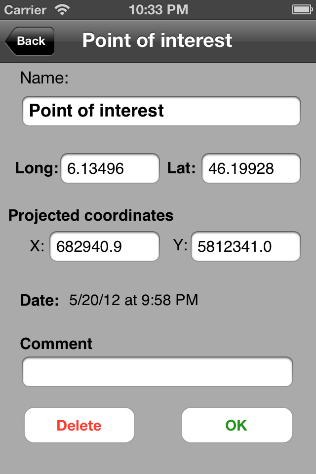
Do you have maps that you would like to use offline on your iPhone/iPad with GPS positioning? Discover Multiplans, a powerful map application in which you can import your maps (whatever their source) and view them offline with a great multitouch experience and pinpoint accurate GPS positioning. Multiplans can moreover record tracks and save points of interests.
Multiplans has been designed to offer a great map viewing experience: simple uncluttered interface, map shown full screen (a single tap toggles on/off the display of overlay information), ultra-fast scrolling and zooming.
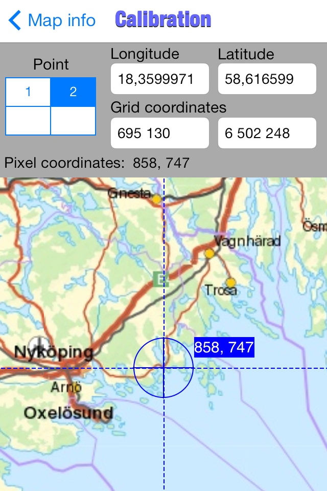
With Multiplans, you don't have to buy again maps that you already own, just to use them on your iPhone. No subscription either that will soon expire. To use a map on your iPhone/iPad, simply transfer the map image into Multiplans (with a .map or ref.txt calibration file if you have one). Maps can be also calibrated entirely within Multiplans by defining graphically calibration points on the map.
A few sample maps are provided with Multiplans: a world map, a map of Switzerland, etc. A few more maps can be downloaded free of charge from www.multiplans.net. Multiplans is compatible with almost all coordinate systems used in the world. To import your own maps into Multiplans and have accurate GPS positioning, the map needs to be calibrated (see www.multiplans.net). Maps from OpenStreetMap (for any region in the world), as well as maps from similar mapping web sites, can be imported into Multiplans very easily by using the free program mobile atlas creator.
Visit www.multiplans.net for more information.
IMPORTANT NOTES:
- Continued use of the GPS running in the background can dramatically reduce battery life on the iPhone or iPad.
- Multiplans' features, including map and location accuracy, should not be depended upon in situations where inaccuracies or errors could cause danger, commercial loss or any other problem. Though we did our best to make Multiplans an excellent app, it is provided as is with no warranty.
Hide..Show more..
Screenshots
User Rating
5 out of 5
2 ratings
in United Kingdom
5 star
2
4 star
0
3 star
0
2 star
0
1 star
0
Ratings History
Reviews
Great app
I would agree with the earlier reviews that this is a great app if you're prepared for a few tries at calibration and a steep learning curve.
I'm using it to get around Mauritius using a map I stitched together. It's certainly accurate enough for that and I'm able to save points of interest and to record tracks and show them as overlays.
Calibrate the map using data from google maps (right or control click on the map and choose 'what's here' to reveal long/ lat info- notice that the long and lat boxes are the opposite way around in multiplans!
Full marks though for a simple and useful app.
Fantastic!
Just what I was looking for. I can import a picture of my own map and calibrate it on the device. Many thanks and keep up the good work!
Terrific app for map-geeks and cartographers
I fully agree with the previous review of this app - if you are fluent in latitude, longitude and the UTM coordinate system, then this is for you. I am not, but it looked to be ideal for what I needed, so I gave it a try. Getting a segmented map loaded was the easy bit, getting it correctly calibrated was a real pain as all the maps I produced showed me to be swimming in the middle of the Atlantic !!!
Anyway, after several failed attempts I emailed the developer - who has been a real star; Vincent could not have been more helpful in pointing out the error of my ways and teaching me how to calibrate my map correctly. It's funny how easy it is when you know what your doing ;-). What would make this a top app for everyone would be the ability to calibrate a loaded map (the easy bit) by clicking a button within the app to open into open Google maps, find 2-3 suitable coordination points that you have clicked on in the app and then to merge the data to produce a calibrated map - voilla!!. Maybe easier said than done, but calibration is the only issue (especially when you don't know what your doing), sort that issue and this will be a killer app to see off the expensive 'Memory Map' and 'Routbuddy' stuff that costs a fortune as OS map data is now freely available on the net.
Overall I'm delighted I stuck with it, a nice addition to my iPad.
A versatile app that suits only a dedicated user
This app has the rare asset that any map can be loaded into it - you are not obliged to accept Google Maps. I, for example, prefer the Swiss Topo maps and I can upload them. With this flexibility comes the need for precise creation of the map and data file for the app. This needs time, care and patience. For me the result is worth it but I expect many users will be so alarmed by the complex preparation as to abandon the app. An app for the serious practitioner not the amateur in a hurry.