Garmin Explore™
Explore with a Garmin device
#1 Keyword Rankings
Today
Top 10 Rankings
Today
Top 30 Rankings
Today
Top 100 Rankings
Today

Description

Map, Track, Sync and Share Your Trek From Anywhere

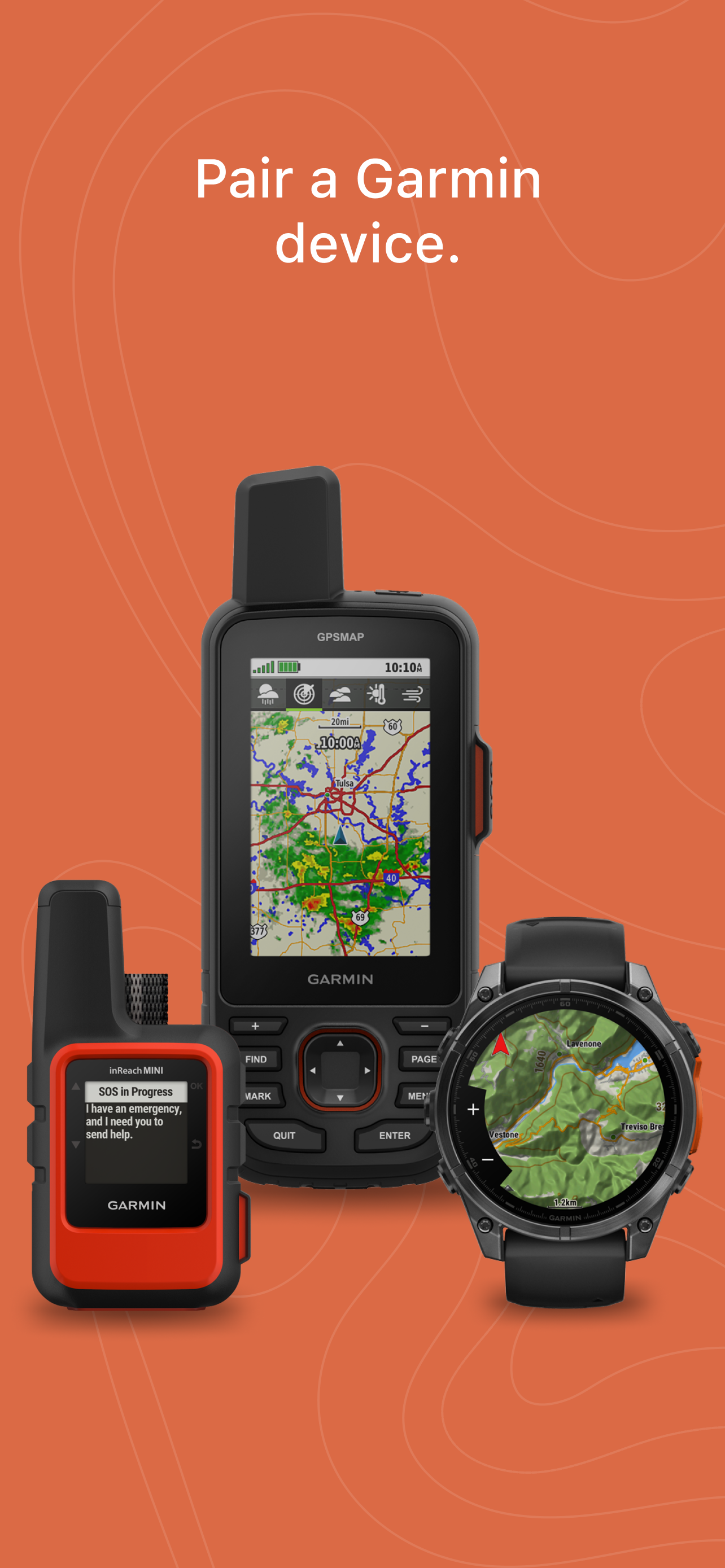
For adventure seekers, explorers and outdoor enthusiasts, the Garmin Explore ecosystem offers a complete mobile navigation solution that — when paired with a compatible Garmin device¹ — lets you map, track and navigate your trek from anywhere with unlimited cloud storage.

Garmin Explore provides basic trip planning or viewing of maps you’ve preloaded on your device. Or you can use the mobile app to pair your smart device via BLUETOOTH®² technology with a compatible Garmin GPS device, so you can do and see even more.

Access Online Connectivity

Garmin Explore provides free online access to a wide range of additional capabilities. For example, you can download detailed topographic maps, color aerial imagery and other navigation aids directly to your mobile device. The maps and navigation data loaded onto your device can be used anywhere, anytime — even when you’re out beyond the reach of cellphone towers or internet connections.

Manage Your Collections, Tracks and Routes

Review and edit your waypoints, tracks, routes and activities in your library. Add them to a collection to keep all the recorded data from a certain trip together in one place. For example, if you’re taking a long trip, you can plan different waypoints, tracks and routes for each day of the trip and combine them into one collection.

Your Mobile Cloud Connection

The Garmin Explore app will send and store the waypoints, planned routes, GPS tracks and Garmin activities you've recorded in the cloud, allowing you to access and use that data on the Garmin Explore web site to plan or review your adventures. You can also sync your cloud-stored data with a compatible Garmin device. A Garmin account is needed to store your data in the cloud. Your activities (e.g., runs, walks, hikes, etc.) include data such as distance, pace, activity time, location, etc. that were recorded by your device.

More Off-grid Capability with inReach® Technology

Use Garmin Explore with your inReach enabled devices, such as the GPSMAP® 66i navigator and satellite communicator, to turn your mobile device into a true off-the-grid satellite companion. In an emergency, you can trigger an interactive SOS to the GEOS 24/7 emergency response team. Two-way messaging and LiveTrack location tracking via the 100% global Iridium® satellite network let you stay in contact globally. The Garmin Explore app allows you to access your phone’s contact list for easier messaging and sharing when connected.

What You Get with Garmin Explore

• Unlimited map downloads; access topographic maps, USGS quad sheets and more
• Aerial imagery
• Waypoints, tracking and route navigation
• High-detail GPS trip logging and location sharing
• Unlimited cloud storage of routes, waypoints, tracks, and activities
• Online trip planning

1. https://explore.garmin.com/appcompatibility

2. The Bluetooth word mark and logos are registered trademarks owned by Bluetooth SIG, Inc. and any use of such marks by Garmin is under license.
Hide.. Show more..

Screenshots

User Rating

2.41 out of 5

22 ratings in Austria

5 star
6
4 star
0
3 star
1
2 star
5
1 star
10

Ratings History

Reviews

Alles Top

Seereiter on

Bin schon seit den 90 er Jahren Nutzer von Garmin Geräten. Mit den vorigen Geräten und Handhabung hatte man so seine Mühe.Bei Karten und Übertragung auf Google Earth insbesondere die Streckenplanung war eine echte Aufgabe.Benutze jetzt GARMIN Explore mit super Karte und guten Wegmarkierungen sowie die Streckenerstellung ist äußerst easy. Einzig ein umschalten auf Satellit wäre wünschenswert. Benutze das Montana 700 für Reittouren in unterschiedlichen Regionen. Die beste Entscheidung seit ich Navis benutze !!

LiveTrack not available

me_#129 on

- Die Planung am App ist ok aber nicht berauschend. - Navigation zu Einstiegspunkten nicht verfügbar. - Karte ok - LiveTrack nicht verfügbar. Zusätzlich Apps / Webseiten notwendig. LiveTrack bei Wandern auf der Fenix 7x / Forerunner LTE nicht verfügbar. Da Garmin aus der Navigation kommt erwarte ich mir viel mehr!

Erschütternd

HH.. on

Das Topo Active Kartenmaterial ist lausig, tut mir leid, aber erwas Freundlicheres fällt mir dazu nicht ein. Die Synchronisation mit dem Geät ist extrem langsam, und die Funktionalität nicht mal ein Bruchteil der gar nicht so schlechten Basecamp Software. Also wirklich ein Schritt zurück.

Untauglich

HH.. on

Das mag ganz nett sein, wenn man eine Handvoll Punkte und Wege speichern will, aber bei mir haben sich über die Jahre sehr viele angesammelt, und das System ist damit komplett überfordert. Synchronisieren dauert etwa eine Stunde, obwohl ich das nur für einen Teil der Datenbank mache. Die Webansicht blockiert, sobald ein BirdsEye Bild dazukommt, oder mehrere Elemente gleichzeitig angezeigt werden sollen. Und ich habe eine sehr leistungsfähige Internetverbindung.

Alles gut soweit

JTowellie on

Nutze InReach Mini 2 und Explore seid 3 Monaten, bisher alles top.

Excellent planning for hiking and mountain biking

helixpteron on

If you can read contour lines this app is perfevt for planning a hike or mountain bike trail. My only wish would be a possibility to blend the topo map with a satellite image background.

Top App

Krebsl on

Super Ergänzung zur fenix 7. Auch die Web-Version ist spitze.

Funktion?

Ralfiii___ on

Funktioniert nicht - fenix 7x solar

Katastrophe

Calefant on

Vielleicht für Wanderer nutzbar und das nur bedingt (Gpsmap66sr). Für Kfz (ZumoXT) kaum anwendbar, kann keine Autobahnen routen! Keine eigenen OSM Karten anzeigen! Verwendet beim Routing Wander-, Geh und sonstige nicht Befahrbare Wege!! Bitte Garmin das geht besser, denn SO gehts NICHT!

ausbaufähig

andy9605 on

nicht wirklich verwendbar keine Alpenvereinskarten

Store Rankings

Ranking History

Category Rankings

Chart
Category
Rank
Top Free
29
Top Free
44
Top Free
48
Top Free
49
Top Free
50

Keywords

Users may also like

Name
PeakFinder
The mountains are calling!
Avenza Maps
GPS, Trails, Hiking, Offroad
Topo GPS - Topographic maps
Topografische Karten
FarOut Guides
GPS Maps: Hiking Biking Paddle
Topo Maps+
GPS Maps for Hike, Hunt, Trail
Trailforks
Trail map for MTB, hike, run
Gaia GPS: Wander App
Topo, Wandern, und Bergsteigen
FATMAP: Ski, Wandern, Fahrrad
3D Karten & Outdoor Guides
CalTopo
Backcountry mapping evolved
iTAK
Team Awareness Kit
Show More

Revenue and Downloads

Gain valuable insights into Garmin Explore™ performance with our analytics. Sign up now to access downloads, revenue, and more.

App Info

Category
Navigation
Languages
English, Arabic, Bulgarian, Croatian, Czech, Danish, Dutch, Estonian, Finnish, French, German, Greek (modern), Hebrew (modern), Hungarian, Indonesian, Italian, Japanese, Korean, Latvian, Lithuanian, Malay, Norwegian Bokmål, Polish, Portuguese, Romanian, Russian, Chinese, Slovak, Slovene, Spanish, Swedish, Thai, Turkish, Ukrainian, Vietnamese
Recent version
3.12.1 (2 weeks ago )
Released on
Oct 15, 2018 (5 years ago )
Last updated
4 days ago