Description
OFF-GRID NAVIGATION
When paired with your compatible Garmin device, the Garmin Explore app lets you use your mobile device for outdoor navigation, trip planning, mapping and more — with or without Wi-Fi® connectivity or cellular service.
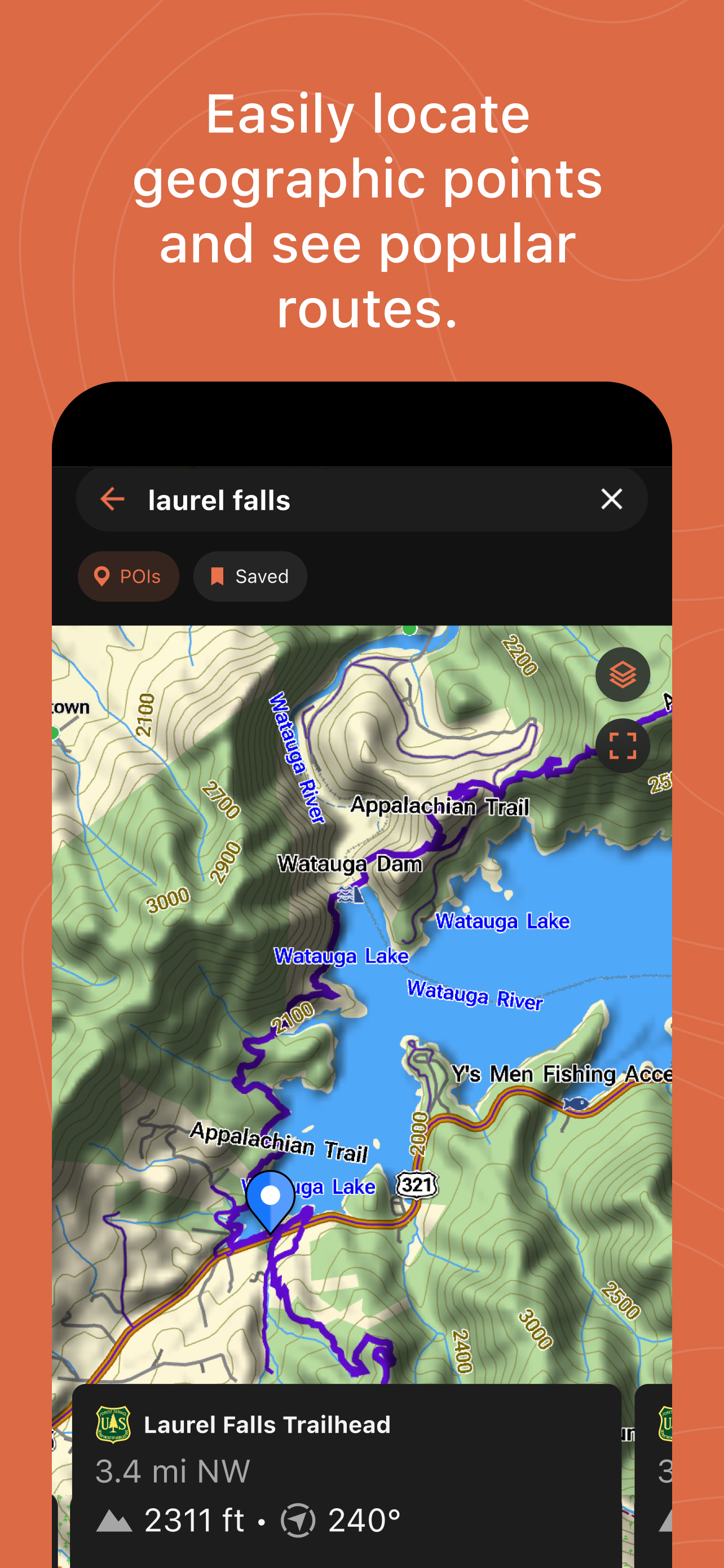
SEARCH TOOL
Easily locate geographic points — such as trailheads or mountain summits — associated with your adventure.
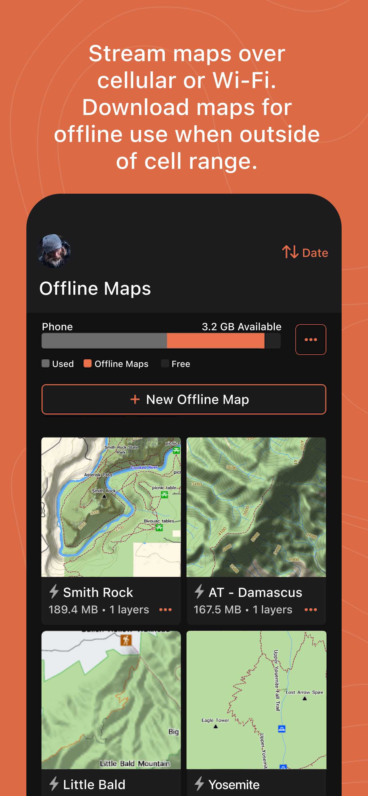
STREAMING MAPS
For pre-trip planning, you can use the Garmin Explore app to stream maps when you’re within cellular or Wi-Fi range — saving valuable time as well as storage space on your mobile device. Download maps for offline use when venturing outside cellular range.
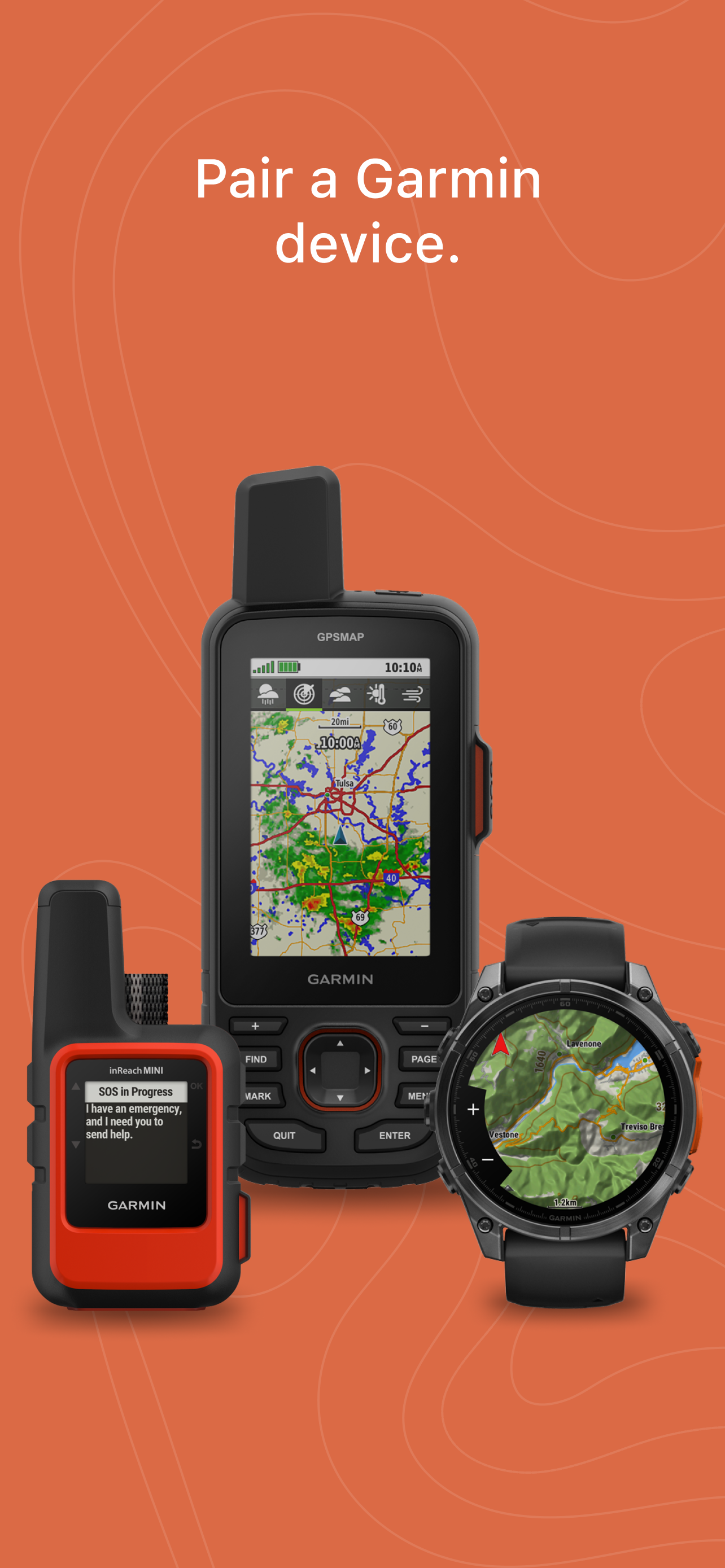
PAIR, SYNC AND SHARE
With Garmin Explore, you can pair your smartphone or tablet with your compatible Garmin device to sync and share data for off-grid adventures. Use downloadable maps for navigation anywhere.
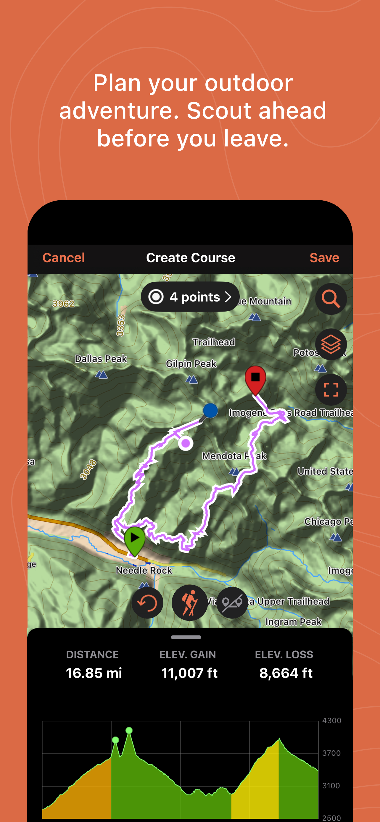
EASY TRIP PLANNING
Plan your next trip by downloading maps and creating courses. Specify your start and finish points, and automatically create a course you can sync with your compatible Garmin device.
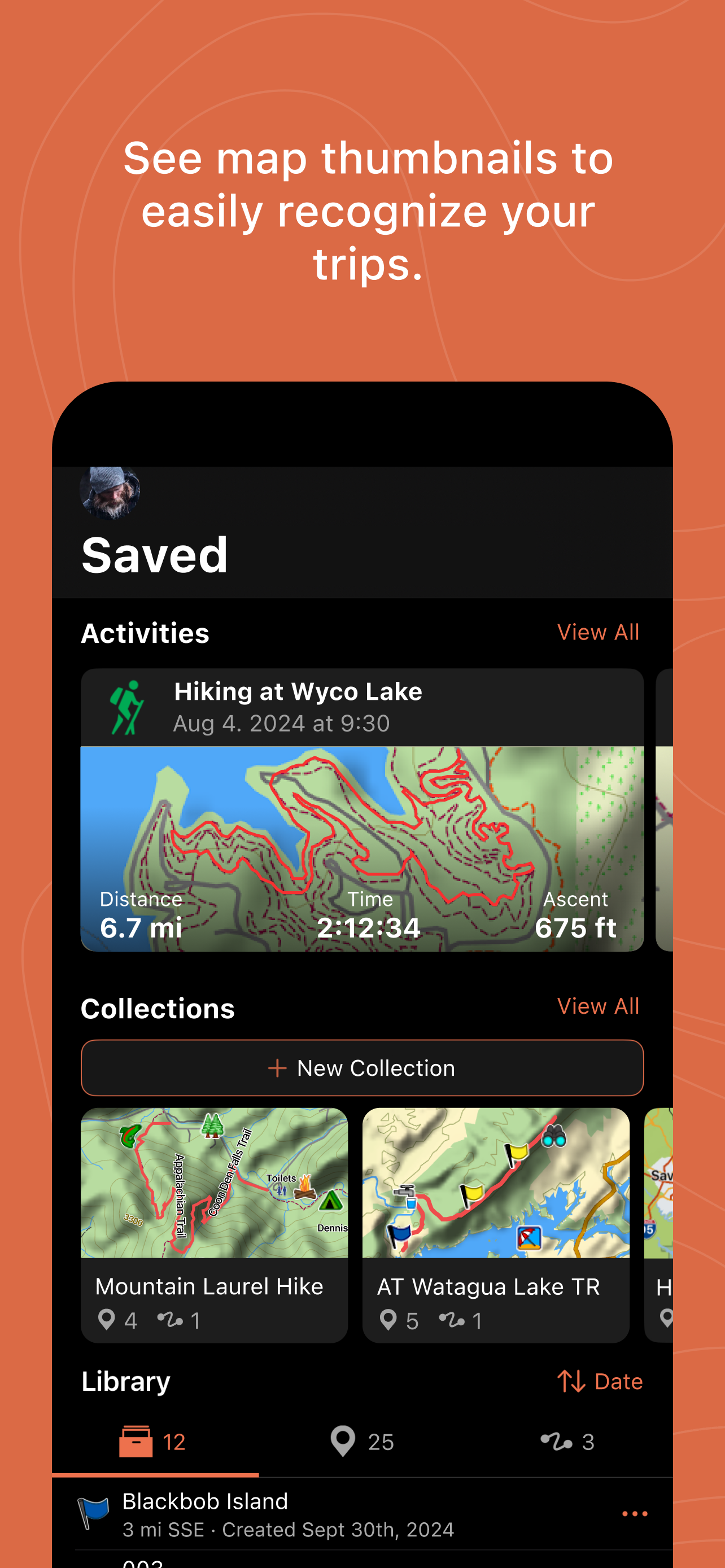
ACTIVITY LIBRARY
Under the Saved tab, review and edit your organized data, including your saved waypoints, tracks, courses and activities. See map thumbnails to easily recognize your trips.
SAVED COLLECTIONS
The collections list allows you to quickly find all data related to any trip — making it easy to sort and locate the course or location you’re looking for.
CLOUD STORAGE
The waypoints, courses and activities you’ve created will automatically sync to your Garmin Explore web account when you’re within cellular or
Wi-Fi range, preserving your activity data with cloud storage. A Garmin account is required for storing your data in the cloud.
What You Get with Garmin Explore
• Unlimited map downloads; access topographic maps, USGS quad sheets and more
• Aerial imagery
• Waypoints, tracking and route navigation
• High-detail GPS trip logging and location sharing
• Unlimited cloud storage of routes, waypoints, tracks, and activities
• Online trip planning
1. https://explore.garmin.com/appcompatibility
2. The Bluetooth word mark and logos are registered trademarks owned by Bluetooth SIG, Inc. and any use of such marks by Garmin is under license.
Hide
Show More...