Hiking & Skiing - PeakVisor
Peak Finder with 3D Maps
#1 Keyword Rankings
Today
Top 10 Rankings
Today
Top 30 Rankings
Today
Top 100 Rankings
Today

Description

PeakVisor will make you a champion of mountain navigation, putting state-of-the-art Peak Identification, 3D Maps, Trails, and outdoor GPS tracking into the palm of your hand. Our app is a one-stop shop for all your mountain adventures: hiking, skiing, climbing, mountain biking, and more. But PeakVisor is more than just another outdoors app; it’s an immersion into a carefully crafted 3D world that will give you an unprecedented understanding of the nuances of a mountain’s terrain.

“PeakVisor uses your iPhone’s camera and augmented reality (AR) technology to display names and elevations of nearby peaks. The information will appear on your phone like magic.”
- App Store, Take the Trail Less Traveled

Here’s a brief orientation on the tools we offer to get oriented in the mountains:

● 3D Maps
As human athletic achievement progresses in the mountains, so does the technology to assist your adventures. With PeakVisor, you unlock the topo maps of the future; our cutting-edge technology with high-precision terrain modeling offers deep insight into the mountain landscape of your choice. With one glance, you be blessed with years of knowledge about an area’s terrain.

● Identify Peaks
Identify more than a million mountains, hills, buttes, spires, and more from all over the world, with a detailed profile for each of them! Our app shows you altitude, topographic prominence, mountain range, national parks or reserves, as well as photos and additional Wikipedia articles.

● Plan Hiking Routes
A vast network of worldwide hiking trails and walking pathways included in PeakVisor’s 3D Maps will help you compose a hiking route which includes evaluating the distance you can expect to hike as well as a route’s elevation profile and estimated time for completion.

● Skiing
In winter mountain sports, PeakVisor’s topographic 3D Maps allow a visual understanding of the terrain and provide detailed information about mountain lifts, ski resort trails, and backcountry ski touring routes. The app also offers features such as winter mode and a slope steepness overlay to identify avalanche terrain on your route.

● Cable Cars and Mountain Huts are inlaid onto our 3D Maps, complete with schedules. This is especially useful in Europe, where many objectives involve a cable car ride to gain some altitude, lest you want to do some genuinely punishing climbs. And you haven’t experienced the old-world mountain culture until you’ve had a memorable meal and night at a rustic mountain hut in the high country.

● Peak Bagging
The app offers monthly climbing challenges and Peak Bagging competitions to keep the motivation where it needs to be…UP.

● Animated Flyover Videos
You can even initiate a ‘Flyover,’ our visually stunning animations that give you a token video of your route to show family and friends or inspire some memories down the road.

● GPS Tracking
Track any outdoor adventures, whether hiking, skiing, mountain biking, etc. Post-adventure, you can visualize your route in the miniature 3D world, check out stats like distance and elevation gain, and export a GPX file of your new route.

● Lock-Screen Navigation

● All Features Work Offline

PeakVisor is the Swiss army knife for outdoor adventure, one that you will soon find indispensable while in the mountains. With so many features at your fingertips, you’ll find value from the app whenever you're on the trail.

PeakVisor PRO is a premium subscription that allows you to use the app without any limitations. By subscribing to PeakVisor PRO you make it possible for us to focus on the continued development of the app. PeakVisor PRO is available as a monthly or annual subscription. We have no advertising on the app; all revenue comes from our user subscriptions. We constantly modify the app and offer an update each week, always with new features and fewer bugs. You may find more details in our Terms and Privacy Policy by the link → https://peakvisor.com/en/terms.html
Hide.. Show more..

In-Apps

Hike & Ski Forever
$119.99
One Year of Hiking & Skiing
$31.99
One Month of Hiking & Skiing
$4.99

Screenshots

User Rating

4.51 out of 5

867 ratings in Canada

5 star
638
4 star
129
3 star
44
2 star
12
1 star
44

Ratings History

Reviews

Needs to be fixed!

Екатерина ' on

Amazing app, but after the last update I can’t open the app. I click on it and it just closes:( (iPhone XR)

Drains battery

jdog hiker 1233 on

Not as good as the preview, uses lots of the phone battery so not ideal to track or use in hikes. Phone heats us when app is open. Not worth paying for, would not recommend.

Would be good if it works

Scl0582 on

Doesn’t work that great. Mountains that I 100% know the name have the name attached way off course. And it does not work offline as described

Crap

D123shaw on

Tried to use my once a day location. App crashes and told me I had to pay for pro to use the app. Yeah right.

wow.

j0hn-d on

totally amazing app. if you are into hiking or just like to look at the horizon, this is a must have. try it; the app will sell itself.

Free version is useless.

VanguardHydra on

I just want to identify peaks from a distance. When trying to calibrate the AR with my camera it shut off saying one location per day.

requires too many acess. otherwise you arenot allowed to use it

Iyner629 on

hard to use

Doesn’t work

Applepop410 on

It was completely off by a long shot, it was saying lasquetti island was little mountain on Vancouver island. Lol

Waste of time

sarabarabridgwidg on

I downloaded and opened, Matterhorn screen appeared and seconds later went black and shut down. I figured something happened during download, so I deleted and then installed once more. Same thing happened again. Total waste of time and data.

Not working for me

Nnc99 on

It shows the mountains further back from the ones I’m looking at. It won’t label the ones closest to me. Very frustrating.

Store Rankings

Ranking History

Category Rankings

Chart
Category
Rank
Top Grossing
4
Top Grossing
4
Top Grossing
4
Top Grossing
5
Top Grossing
6

Keywords

Users may also like

Name
PeakFinder
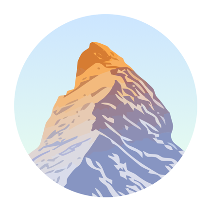
The mountains are calling!
FarOut Guides
GPS Maps: Hiking Biking Paddle
Topo Maps+
Offline Topographic Maps & GPS
Gaia GPS: Mobile Trail Maps
Hiking, Overlanding, Camping
Garmin Explore™
Explore with a Garmin device
FATMAP: Ski, Hike & Trail Maps
3D Maps & Outdoor Guides
Outdooractive
Reliable planning & navigation
CalTopo
Backcountry mapping evolved
onX Backcountry Trail Maps GPS
Biking, Skiing, Hiking Trails
Earthmate
Text and Navigate with inReach
Show More

Revenue and Downloads

Gain valuable insights into Hiking & Skiing - PeakVisor performance with our analytics. Sign up now to access downloads, revenue, and more.

App Info

Category
Travel
Languages
German, English, French, Italian, Japanese, Catalan, Korean, Polish, Portuguese, Russian, Slovak, Spanish, Chinese
Recent version
5.12 (1 day ago )
Released on
Dec 21, 2016 (7 years ago )
Last updated
3 days ago