i-Boating: Marine Charts & Gps

Lake Maps & Fishing Spots

Published by: Bist
Downloads
Revenue

Description

This App offers access to Marine Charts for USA,Canada,UK/Ireland,Germany,Netherlands/Holland &
Europe Rivers (Danube,Drava,Rhein etc). Coverage includes NOAA marine vector
charts,freshwater lake maps,USACE inland river maps (HD/1ft/3ft bathymetry
included where available),charts derived from UKHO & CHS data. First marine GPS app to have route assistance with Voice Prompts for marine navigation. You can create new boating routes or import existing GPX/KML routes. It supports Nautical Charts course up orientation. Includes Tide & Currents prediction.
►FEATURES
√ Beautiful & detailed Hardware/GPU accelerated vector charts (text stays upright on rotation)
√ Long press to query the details of Marine object (Buoy,Lights,Obstruction etc).
√ Customizable depth(Ft/Fathom/Meter) & distance units(km/mi/NM)
√ Customizable Shallow Depth.
√ Record tracks,Autofollow with real-time track overlay & predicted path vector.
√ Voice Prompts for marine navigation (requires GPS )
√ 1ft / 3ft depth contour maps for anglers for selected lake maps.
√ Supports GPX/KML for boating route editing/import.
√ Tide & Currents prediction.
√ Seamless chart quilting of marine charts
√ Enter or import Waypoints.
► MAPS
It includes unlimited updates for 1 year.
√USA: The maps include coverage of all NOAA marine vector charts (ENC),USACE inland river maps,freshwater lake maps for more than 7K lakes. The charts include HD/1ft/3ft bathymetry where available.Incl. NOAA raster where ENC not available.
√Canada:Incl. CHS data(incl. major Lakes).
√UK/Ireland: Derived from UKHO charts.
√Australia
√Germany: derived from BSH data
√Europe Inland Rivers:Donau/Dunaja,Rhine,Garonne,Moselle,Drava,Sava,etc
√Norway
√Finland
√Sweden
√Croatia
√Ukraine(Black Sea)
√Caribbean
√New Zealand
√Spain
√Brazil
√Argentina
√Cyprus
√Falklands
√Seychelles& Mauritius
√Denmark
√Malta,Cyprus & S. Mediterranean
√S. China&Malaysia
√South Africa
►ROUTE MANAGEMENT / TRIP PLANNING
√ Create New Route/Edit Existing Routes
√ Move Points
√ Add points to an existing route leg
√ Delete / Rename points
√ Import GPX,KML & KMZ files
√ Plot/Edit Routes
√ Enter Waypoints
√ Share/Export Routes,Tracks&Markers
√ Reverse Routes
►SLIP TO SLIP AUTO ROUTING
►GPS FEATURES
√ Auto Follow
* Real Time Track Overlay
* Predicted Path Vector
* Course Up(Text stays upright)
* Speed & Heading
√ Route Assistance With Voice Prompts
* Prompts when approaching a boating route marker
* Continous distance & ETA updates
* Alerts when sailing/boating off route
* Alerts when boating in wrong direction
√ Record Tracks
►TIDE & CURRENTS
* For US,Canada,UK,Germany & New Zealand
* High/Low Tides
* Tidal Current Prediction
* Active Current Stations
►Instrumentation
√ Marine AIS & (NMEA AIS and GPS over TCP/UDP)
√ Wind direction & Speed,Marine Sonar depth,Water temperature
√ Auto Pilot
► SHARING
* Share tracks/routes/markers on Facebook & Twitter
* Export tracks/routes/markers as GPX files.
SUGARLOAF KEY-KEY WEST
PORT RICHEY TAMPA BAY - CLEARWATER HBR
EAST BAY-WEST BAY FLORIDA
INTRACOASTAL WATERWAY MATECUMBE-GRASSY KEY
CHESAPEAKE BAY CAPE CHARLES-NORFOLK HARBOR
ANCLOTE KEYS-CRYSTAL RIVER
ST JOSEPH SOUND
MIAMI HARBOR
Minnesota lakes - Kabetogama,Minnetonka,Waconia,Leech,Mille Lacs
Lake Keowee,Jocassee,Hartwell,Greenwood,Lake Murray
Mark Twain,Ozarks,Table Rock
Lake St.Clair
Lake Kentucky
KEY WEST-THE MISSISSIPPI RIVER
SAN PEDRO CHANNEL
LAKE MICHIGAN STONY LAKE-POINT BETSIE
APALACHICOLA BAY-CAPE SAN BLAS
EAST CAPE-MORMON KEY
CAPE HENLOPEN-INDIAN RIVER
CHESAPEAKE BAY CAPE HENRY-THIMBLE SHOAL
DULUTH-SUPERIOR
MONHEGAN ISLAND-CAPE ELIZABETH
ONTARIO - CLAYTON-FALSE DUCKS
Winnipesaukee
MIAMI-MARATHON,FLORIDA
CAPE MAY-FENWICK ISLAND
MISSISSIPPI RIVER-GALVESTON
CAPE CANAVERAL-KEY
DELAWARE RIVER WILMINGTON-PHILADELPHIA
FLORIDA KEYS SOMBRERO KEY-SAND KEY
SAN PABLO BAY
RAINY LAKE BIG ISLAND MINN-OAKPOINT
INTRACOASTAL WATERWAY-BISCAYNE BAY
EVERGLADES NTL PARK
HURON
TAHOE
CHESAPEAKE DELAWARE CANAL
BACKGROUND GPS CAN DECREASE BATTERY LIFE
Hide.. Show more..

In-Apps

UK / Ireland - Marine Charts
£29.99
UK / Ireland : Marine/Fishing
£29.99
UK / Ireland: Marine Charts &
£29.99
Europe Inland Rivers-Waterways
£19.99
UK /Ireland - GPS Nautical Charts
£29.99
UK / Ireland: Boating & Fishing Maps
£29.99

Screenshots

User Rating

4.61 out of 5

825 ratings in United Kingdom

5 star
624
4 star
140
3 star
26
2 star
8
1 star
27
Ratings History

I-Boating Installs

Last 30 days

I-Boating Revenue

Last 30 days

I-Boating Reviews

Nice App

dukakonCars on

United Kingdom

Very useful information within 👍

No customer service

RikRutter on

United Kingdom

I’m new to chart plotters on my phone, and am beginning to regret buying i-boating rather than one of the other more popular apps. Every time I open the app it tells me there are no maps loaded and demands I buy some. This despite my having bought the UK Ireland Netherlands and France folio. So I tried to contact Customer Service to ask why, and how to resolve the issue. Forget it - there is no way to contact them.

Orkney to Troon I had know nav gear

Badbadanger on

United Kingdom

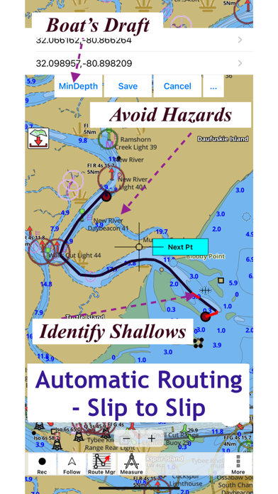
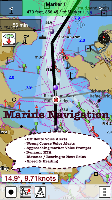
Hi all about this app! It’s fantastic so basically I bought a boat in Orkney and I had to take it to Troon south west Scotland,anyway I lost all power and I had this app and I used this app for 100nm and right through the night into a shallow depth harbour anyway I had to get assistance wait for it…. I wanted the best route ,so not only was it the harbourmaster that helped me but he was the life boat skipper and he used this app and made me a route to follow.down into the Caledonia canal.the app is perfect and coming from a fisherman is well worth its worth! I definitely recommend this app and I will be using all the time on my iPad as it’s a bigger screen. Tom

Excellent

One man with a dog on

United Kingdom

Tried it out for the first time last Saturday. Works better than dedicated gps. Unfortunately I had a mishap when I got back into the harbour after mooring I dropped my iPad over the side and it now lies at the bottom of the harbour. Had to buy a new one and have the app transferred .

Subscription

Ninjasumi on

United Kingdom

Great app but why so expensive?

App

paul meik on

United Kingdom

This app has to be by far the best domestic boating app I’ve seen. Any info needed is all there in front of you. First class.

Well good

Englishalan on

United Kingdom

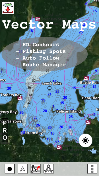
I love how much you can get from this and how you can see all the markers on all the rivers. Love it

Great app - so easy to Plot a route and use

crskoala on

United Kingdom

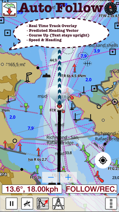
We used the app for the first time when sailing in Menorca … so easy to plot a route and fab that once loaded it works off GPS with no data required! Very accurate - so glad we found it!

Superb

daveyabsolute on

United Kingdom

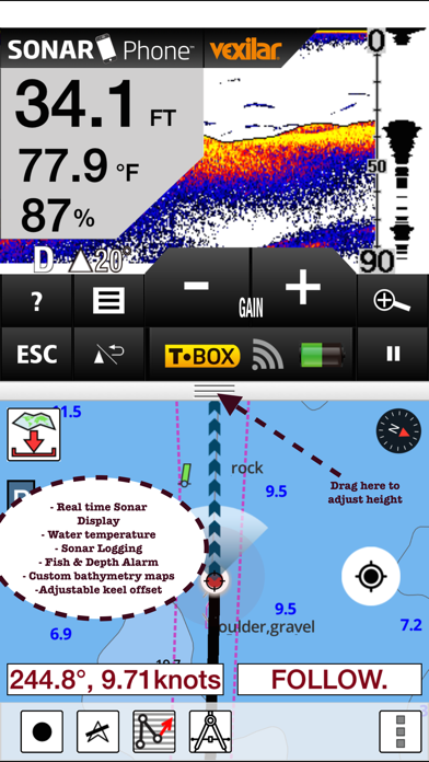
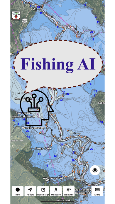
I find this a great app to use for sea fishing.

Looks dodgy, isn’t bad, does the job

i didnae sink yet on

United Kingdom

It’s no bad, just a bit dodgy looking, but no bad

Store Rankings

Ranking History
Category Rankings
Chart
Category
Rank
Top Grossing
3
Top Grossing
17
Top Grossing
23
Top Grossing
30
Top Grossing
39

Keywords

I-Boating Competitors

I-Boating Revenue and Downloads

Gain valuable insights into I-Boating performance with our analytics.
Sign up now to access downloads, revenue, and more.

App Info

Category
Navigation
Publisher
Bist
Languages
Dutch, English, Finnish, French, German, Norwegian Bokmål, Russian, Swedish
Recent version
150.0.0 (1 week ago )
Released on
May 30, 2015 (9 years ago )
Last updated
2 days ago