iNavX: Marine Navigation
Sailing & Boating Chartplotter
#1 Keyword Rankings
Today
Top 10 Rankings
Today
Top 30 Rankings
Today
Top 100 Rankings
Today

Description

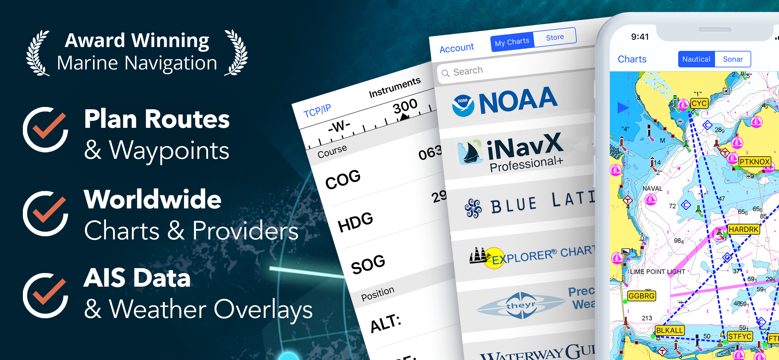
Marine navigation is made easy with iNavX - the world's #1 handheld Chartplotter. Access marine charts, maps, weather, AIS and more!

iNavX is the only app to give you complete worldwide chart coverage, from all your favorite charts providers, including the ALL NEW iNavX Professional+ Chart series! Fully enabled with one-touch access, iNavX gives users access to the broadest set of marine charts and maps from multiple providers including:

• iNavX Professional+ Charts
• Blue Latitude
• CHS
• Explorer
• Theyr Weather
• Waterway Guide
• … and more

How does iNavX take handheld marine navigation to the next level?
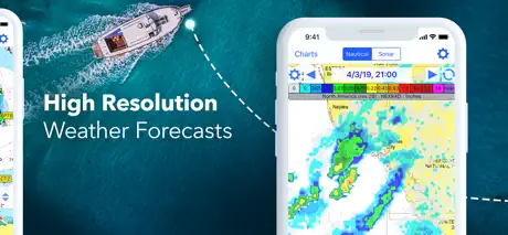
• Sailors - Plan sailing routes with waypoint and route management. Get proactive sail management with GRIB weather forecasts and then keep watch with AIS overlays and integration with your onboard systems. Plus, you can remember your great sailing locations by geotagging photos.
• Boaters - Stay up to date on boating conditions with forecasts that include currents, winds, and swells. Manage your boating equipment with nautical instrument integration and then save great boating routes to share with the track log.
• Anglers - Discover new fishing spots by scouting out holes and inlets. Locate the best fishing conditions by identifying cold fronts and save your best fishing spots with unlimited markers.

Advanced features - iNavX is the most feature rich app available for all sailing and boating needs at a great price:

Advanced Chart Plotter
• Plot your position in real-time using your device's built-in GPS
• Pan, zoom, and rotate charts (including course up)
• Print detailed charts to use in combination with the app

Advanced Navigation
• Create waypoints and plan routes to navigate between them
• Track log allows you to record your route
• Import/export data in KML (Google Earth) or GPX format

Advanced Instrumentation
• Supports NMEA data over TCP/IP (using Wifi)
• Integrates with external GPS, AIS receivers & transponders
• Connect nautical instruments: Depth, Speed, Wind, Engine, Batteries, etc.

Essential Toolkit
• GRIB weather forecast
• Tides/currents
• Anchor alarm
• AIS integration
• Port/navaid search

Download iNavX TODAY and automatically receive a complimentary copy of the official and up-to-date high-resolution NOAA RNC United States marine raster charts.

REVIEWS

“iNavX is the original and still one of the best navigation apps.”
– Practical Sailor

“The most full-featured navigation app around and viewed by many as the standard”
– Sail Magazine

"The #1 recommended marine charting app"
- iMarineApps

iNavX is Compatible with: Theyr Weather, Waterway Guide, AIS, Brookhouse, DigitalYacht, ShipModul, vYacht, Vesper Marine, NMEA 2000, Chetco and more.

NEW CHART STORE
Purchase all your favorite charts. Chart subscriptions vary by chart and provider from $9.99 to $199.99 annually, charged to your iTunes Account, which will automatically renew unless cancelled at least 24 hours before the end of the current period. Auto-renew can be turned off anytime by going to your Account Settings in iTunes after purchase. No cancellation of the current subscription is allowed during active subscription period.

NOTE: Continued use of GPS running in the background can dramatically decrease battery life.

MORE INFO
Website: http://inavx.com/
User's Guide: http://inavx.com/help/

Terms of Use: http://inavx.com/terms
Privacy Policy: http://inavx.com/privacy
Hide.. Show more..

In-Apps

AIS Live
$154.99
C-MAP World Chart
$89.99
Theyr Premium Weather
$79.99
Navionics+ India (iPad)
$139.99
Navionics+ Australia (iPad)
$139.99
Navionics+ S Pacific (iPad)
$139.99
Navionics+ Australia (iPhone)
$58.99
iNavX Professional+ Australia
$79.99
Navionics 50XG Australia, New Zealand, South Pacific and Hawaii - iPad
$134.99
Navionics 50XG Australia, New Zealand, South Pacific and Hawaiian Islands
$57.99

Screenshots

User Rating

4.42 out of 5

373 ratings in Australia

5 star
253
4 star
74
3 star
18
2 star
5
1 star
23

Ratings History

Reviews

Crumphead is wrong

Charloote on

Crumphead you absolutely can but charts for Australia. For a fraction of the cost of paper charts. I use this App as a back up to our Navigation system, regularly. They have fixed the WP problems, hurray! I love the route system and the detail on the charts are fantastic. I import GRIB files with the greatest of ease. Sure, as we're in Australia we need to buy charts but i think thats a very reasonable request. I also have other Nav products but iNavx wins hands down. Well done, love it.

Not fit for purpose

dmn_s27 on

Do not buy this app. It is not fit for purpose. The app costs a small amount then to use it you buy access to the global chart dataset. You download areas of the world in which you are interested. The underlying chart data has no information at all about the light characteristics of lighthouses. None. This renders the app almost useless and potentially dangerous. Lighthouse characteristics are an essential component of a chart. To sell this to the public while unable to display that data is unethical and probably illegal. I have asked for compensation for being tricked into buying this, but have not heard back from iNavX.

International Dateline issue

Ozbullwinkle on

I used this app on a passage across the Pacific Ocean from Panama to Vanuatu loaded with the maps for this area. On the whole the app performed well on my iPad 3G which has built in GPS. But the Achilles heel of this app is when you transit the International Dateline which cuts through Fiji and I assume it would be the same in the N hemisphere as well. This makes it impossible to view the islands of Fiji in detail as you can only look on one side of the dateline and if you want to look on the other side YOU NEED TO SCROLL RIGHT AROUND THE WORLD SO THAT YOU APPROACH THE DATELINE FROM THE OTHER SIDE ie W to E. Also your route line goes right around the world in the WRONG direction which is a safety issue as you cannot then do a scan down your route line from your current position to the next waypoint to see if there are any obstructions along your plotted route. I did not have this issue with the vessels built in Raymarine GPS chart plotter and iNavx really need to get Navionics to fix this issue. Attn iNavx Support - Can you please provide an update on the status of the fix for this very important issue which is crucial for anyone doing Ocean passages near the Dateline.. The initial feedback I posted above is now over 5 years old. Thanks Steve. Dec 2018 Attn iNavx Support - Are you ever going to resolve the serious dateline issues with your app that I have previously reported above? An update would certainly be appreciated by the cruising community..Thanks. Steve Aug 2020 Attn iNavx Support....it really looks bad that you cannot respond with an update regarding this serious deficiency in your app that I first raised 9 years ago now. It makes your app virtually useless for any cruisers doing extended cruising around Fiji. Like seriously, are you going to fix it or not as it is a real safety issue? Steve April 2022

Absolute Scammers

Bartyboy1969 on

All Inavx cares about is taking your money, once that happens good luck if your charts are there let alone working. Example of Inavx ripoff, CMap global charts only work over the Internet and this is not stated anywhere they just want your money, might as well use google earth

You have to pay AU$8 for nothing.

Saulergar on

You have to pay AU$8 for nothing. Every feature in the app has another price. So the app should be free and charge only for what you wanna.

Waste of time and money

MEMEMEMEMEMEMEME83749274;&($'f on

This app does not even show the weather forecast and wind predictions, when you go to look at the weather it says you need to pay $34.99 even though the app alone was not free.

Total and utter rubbish

bjcresswell on

Complete waste of money. It’s just a portal in which to view other charts (which you have to pay for). May as well use the free Navionics app and then pay for their charts (or whatever chart provider is your favorite). I have never wanted an instant refund on an app purchase until now. Alas I’m locked in now...

Rip off

Karajan09 on

Where are you paying $8 you get nothing but an unusable world map and then you have to pay extra $ 60-70 to get your local area. Do not use this if you only want your local 100 mile radius for JetSki or recreational boating as it cost a lot

Australia

mjbvcgdds go oiydfhkoug on

Exspensive for Australia much better options information misleading difficult to remove app

Garbage

Space_invader80 on

Recommend you dont waste you money.

Store Rankings

Ranking History

Category Rankings

Chart
Category
Rank
Top Grossing
1
Top Grossing
13
Top Grossing
20
Top Grossing
22
Top Grossing
23

Keywords

Users may also like

Name
Navionics® Boating
Nautical and fishing charts
C-MAP: Boating
Charts, Planning & Navigation
i-Boating: Marine Charts & Gps
Lake Maps & Fishing Spots
Lowrance: app for anglers
Great fishing charts
savvy navvy: Boat Navigation
GPS Charts Tide Weather AIS
PRO CHARTS - Marine Navigation
ActiveCaptain®
Connect to Your GPS Plotter
Aqua Map Boating
Marine navigation and fishing
TZ iBoat – Marine Navigation
Boat GPS, Charts, AIS, Tides
Wavve Boating: Marine Boat GPS
Navigation, Charts, Tides, Map
Show More

Revenue and Downloads

Gain valuable insights into iNavX: Marine Navigation performance with our analytics. Sign up now to access downloads, revenue, and more.

App Info

Category
Navigation
Publisher
NavX Studios LLC
Languages
English, Dutch, French, German, Italian, Spanish, Swedish
Recent version
5.6.34 (1 day ago )
Released on
Feb 12, 2019 (5 years ago )
Last updated
6 days ago