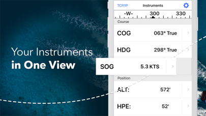
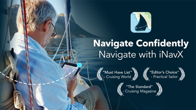
Brilliant for boats with WIFI-NMEA
Displays all NMEA data over large selection of leading charts. Good stuff!


Yes, TeamLynk is free to download, however it contains in-app purchases or subscription offerings.
🤔 The TeamLynk app's quality is mixed. Some users are satisfied, while others report issues. Consider reading individual reviews for more context.
TeamLynk has several in-app purchases/subscriptions, the average in-app price is €103.49.
To get estimated revenue of TeamLynk app and other AppStore insights you can sign up to AppTail Mobile Analytics Platform.

4.17 out of 5
30 ratings in Finland
Displays all NMEA data over large selection of leading charts. Good stuff!
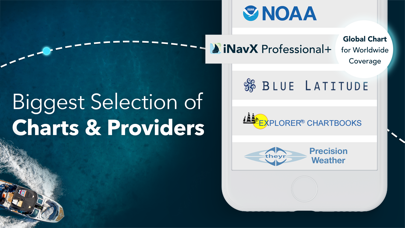
This is close enough to merchant ships's ECDIS. Navigators who are used to ECDIS will like this program. Ships navigators would get mad with Plan2Nav and iSailor!!! So get this one and use Navionics vector based sea charts with it and you will be happy.
Anchor alarm will not suht down by pressing save button as the instruction says...? I must says tuhat I am not hyppy that my App is broken from the start.
The superb product is one thing, but the email customer service relating to support issues is just unbelievable. I had issues importing my waypoints (a huge file), but this guy split the file for me in minutes and I got it working!! I can recommend this product for anyone and the service is just out of this world! :D It would be nice to be able to show waypoint names AND waypoint icons at the same time in saved waypoints.
Read carefully term and conditions. Yes they support Navionics Ipad charts but you can't use the Navionics chart you have purchased from AppStore. They are selling the same chart for double price again... I'm really unhappy with this product.
Best app ever. Always right
A real pain as the maps area you purchased doesn’t show . You need to hunt for the map you want in the menu and upload it each time Makes no sense
The app crashes constantly. You can purchase map sets that will ultimately fail to open or function correctly. I want a refund.
NOAA charts on laptop show changes to marks, but iNavX appears to have stopped permitting the app to update them. used to be when you went into a regions charts the beginning of the year when NOAA updated you could update all the charts that were downloaded. Now it appears that the charts are permanently stuck from to the initial date they were initially downloaded. INavXused to be a useful backup to navigating. Something you could grab after working with something like Expedition. The lack of other chart types to match professional charts used on the main boat and the increasing fees for what is otherwise a secondary service has made this app unnecessary. Real shame. It used to be a nice back up to carry around.
I have been using INavX for over ten years. I was amazed at how low the ratings on the App Store were and felt the need to add a positive review. When I started using INavX in 2011, it was the only iPhone/iPad app that was able to do what I needed. It has served me well for many years, and I feel it is one of the better values in the App Store. INavX has supported my account with updates on several iPhones, iPads, and now my M3 MacBook Pro.
|
Chart
|
Category
|
Rank
|
|---|---|---|
|
Top Grossing
|

|
28
|
|
Top Grossing
|

|
35
|
|
Top Grossing
|

|
38
|
|
Top Grossing
|

|
39
|
|
Top Grossing
|

|
40
|
