Største mansjiten som finns
Ikke kjøp d her

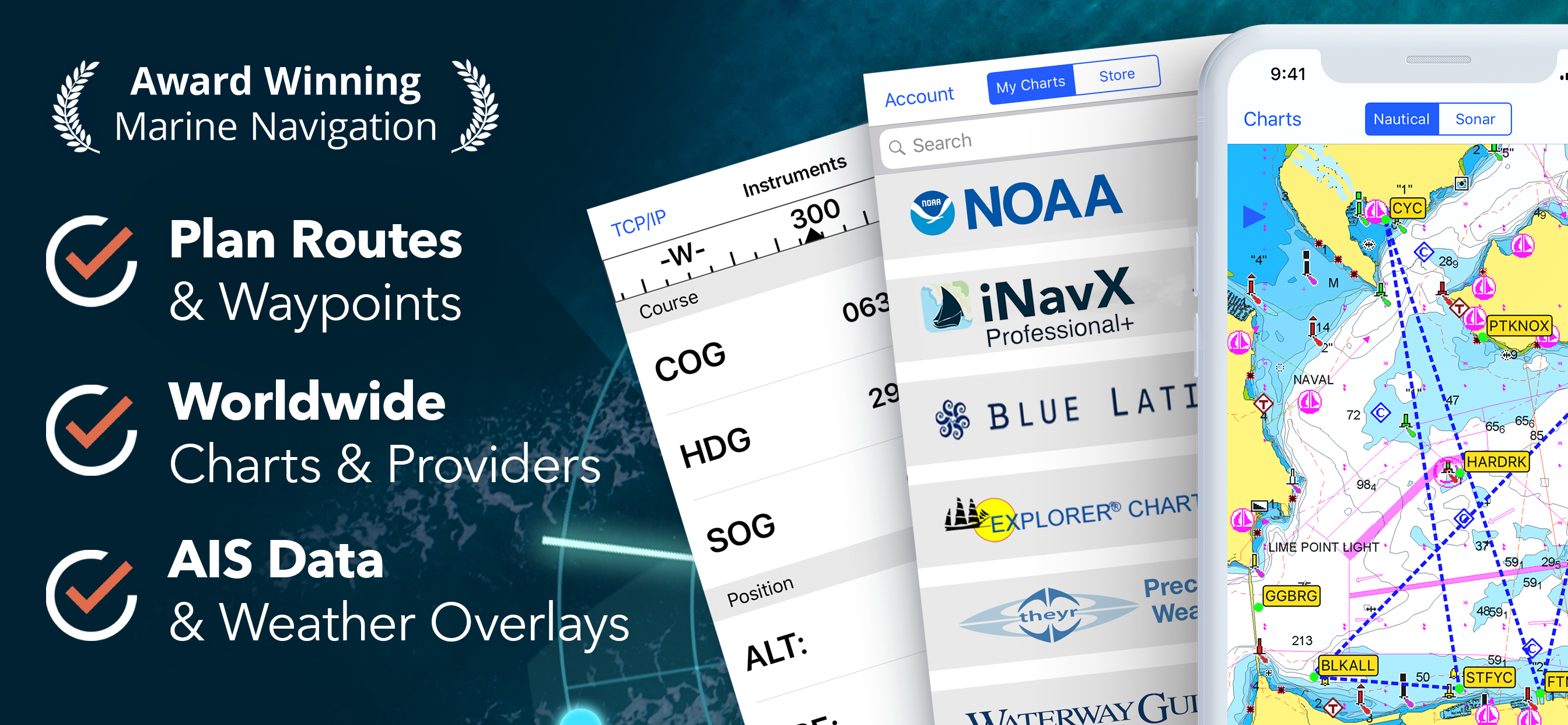


Yes, INavX is free to download, however it contains in-app purchases or subscription offerings.
🤔 The INavX app's quality is mixed. Some users are satisfied, while others report issues. Consider reading individual reviews for more context.
INavX has several in-app purchases/subscriptions, the average in-app price is 599.00 r.
To get estimated revenue of INavX app and other AppStore insights you can sign up to AppTail Mobile Analytics Platform.

4.48 out of 5
94 ratings in Norway
Ikke kjøp d her
They ask for low sum to download the app, the a high sum to use the app. Stay away from it.
Using it everyday as a professional skipper to sail in Northern Norway and Svalbard. Great precision and easy to read. All the useful tools and more: simply Love it.
Perfekt kartprogram
Har prøvd mange program og påstår dette er ett av de bedre.
App had 5 stars from me but after recent updates I haven't been able to use it at all since its constantly crashing when I try to zoom in on the map (Norway).
for them how want a maretime chart dont bay this app its only fake and bluff, save your momy.I need to tell and askThe Dolvoper off this App how much we need to bay more for get a real Maritme chat how is posible to naviget at sea. and way thay send me to to the googel shacrt.. And if poseble sen me a liknk how have the nesesory navegatone tol. so I dont need to be sent to and otherpay side. The price dosent matter.
Best app ever. Always right
A real pain as the maps area you purchased doesn’t show . You need to hunt for the map you want in the menu and upload it each time Makes no sense
The app crashes constantly. You can purchase map sets that will ultimately fail to open or function correctly. I want a refund.
|
Chart
|
Category
|
Rank
|
|---|---|---|
|
Top Grossing
|

|
40
|
|
Top Grossing
|

|
41
|
|
Top Grossing
|

|
43
|
|
Top Grossing
|

|
56
|
|
Top Grossing
|

|
59
|

