No try period
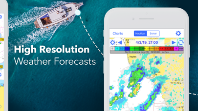
It may be usefull in the USA. No try period available, so no idea what it give in Europe. It looks like it has old fashioned paper maps, no vector system? Removed it


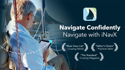
Yes, INavX is free to download, however it contains in-app purchases or subscription offerings.
🤔 The INavX app's quality is mixed. Some users are satisfied, while others report issues. Consider reading individual reviews for more context.
INavX has several in-app purchases/subscriptions, the average in-app price is €91.99.
To get estimated revenue of INavX app and other AppStore insights you can sign up to AppTail Mobile Analytics Platform.

4.32 out of 5
222 ratings in Netherlands
It may be usefull in the USA. No try period available, so no idea what it give in Europe. It looks like it has old fashioned paper maps, no vector system? Removed it
I’ve used iNavX nearly 10 years and was satisfied with the functionality. However recently they sold me outdated charts for the sections time. Until last year I had a subscription on their Navionics charts, when I found out that they hadn’t been updated for over a year. This year I bought the Delius Klasing charts for the Netherlands, again finding out that they were several years old (2015 and 2017). Conclusion: iNavX used to be a nice app. For now I’ve switched to a different app for navigation.
Only Great Lakes
Dissapointed, no map from Europe!!!
In july 2021 iNavx is selling navionics for the Netherlands published in 2018, and not updated. Of course, you only see this after purchase. In three years time, on a sandy coast, bars will have shifted and markers will have been moved, making these charts unsuitable for navigation. This is not only unprofessional, it is outright dangerous.
Fault information provided! NV chart not supported but mentioned multiple times in description. Useless for me, waist of money
The Navionics charts for NL are outdated. This is extremely dangerous on the Waddenzee. The app is great in itself and works flawlesly with my AIS.
There is no free map for Europe. I should buy the map for 99,- yearly. Why don’t you mentioned this before i buy the app. Now it is useless for me. Dissapointed!
Hi, I love sailing with the iNavx-app. Races too. See my five star rating 2 years ago. But beware of the outdated Navionics charts that you can buy too! In May 2019 I paid EUR 95,99 for Navionics+ UK Scotland etcetera for ipad. It is subscription. The chart in question also covers the Dutch inland water like the IJsselmeer. The chart bought in May 2019 was published in July 2018. Almost a year old. And has not been updated since then. It’s now November 2019. Almost a year and a half old. Buoys have been added or replaced or taken out of the water. Don’t relay on these maps, or you could risk getting into danger! And I’m ending my subscription. Solve this iNavx, this is a disgrace imho. 5 starts for the app, but 4 stars deduction for selling far outdated maps for Eur 96 per year. Tip for other inavx users buy Dutch waypoints online at nautin dot nl for safely navigating in The Netherlands.
INavX is a userfriendly intuitive app also showing AIS-info when a wifi equipped AIS Xponder is installed. Sailing in the Netherlands and Western Europe I used this app for many years in combination with Navionics charts (earlier 28XG; now Navionics+ UK/Neth/Bel/Ger/ Fra). These charts were adapted for iNavX use and sold and periodically updated by Fugawi in the past. Unfortunately Fugawi stopped selling and updating these charts in the second half of 2018 and are unsafe for navigation from that moment I experienced. INavX which now sells these charts in-app does not provide periodic updates and directed me to Navionics for further assistance. Navionics in turn however redirected me to iNavX as they have no influence on updating these charts they say. Since my last request for assistance to iNavX on May 15 2019 I still wait for an answer from iNavX. INavX still sells these expensive charts without updating and Navionics apparently thinks it’s no problem that their charts are sold deliberately without meeting the required standards which Mariners may and should expect. As long as this problem is not solved my advice would be not to buy iNavX in combination with Navionics charts. I don’t have experience with other chart providers.
|
Chart
|
Category
|
Rank
|
|---|---|---|
|
Top Grossing
|

|
17
|
|
Top Grossing
|

|
34
|
|
Top Grossing
|

|
34
|
|
Top Grossing
|

|
42
|
|
Top Grossing
|

|
42
|
| Name | Downloads (30d) | Monthly Revenue | Reviews | Ratings | Recent release | |
|---|---|---|---|---|---|---|

Navionics® Boating
Nautical and fishing charts
|
Unlock
|
Unlock
|
50
|
1
|
1 month ago | |

C-MAP: Boating
Personal, offline, marine maps
|
Unlock
|
Unlock
|
21
|
|
1 month ago | |

i-Boating: Mariene kaarten
Vissen, Zeilen & Kanaal GPS
|
Unlock
|
Unlock
|
3
|
|
1 month ago | |

Lowrance: app for anglers
Great fishing charts
|
Unlock
|
Unlock
|
3
|
|
1 month ago | |

Savvy Navvy: The Boating App
GPS Charts Tide Weather AIS
|
Unlock
|
Unlock
|
8
|
1
|
1 day ago | |

PRO CHARTS - Marine Navigation
|
Unlock
|
Unlock
|
3
|
|
1 year ago | |

ActiveCaptain®
Connect to Your GPS Plotter
|
Unlock
|
Unlock
|
28
|
|
2 weeks ago | |

Aqua Map Boating
GPS voor varen, zeilen, vissen
|
Unlock
|
Unlock
|
3
|
|
4 weeks ago | |

TZ iBoat – Marine Navigation
Boat GPS, Charts, AIS, Tides
|
Unlock
|
Unlock
|
7
|
|
2 months ago | |

Dockwa
Dock and mooring reservations
|
Unlock
|
Unlock
|
0
|
|
2 weeks ago |

