OsmAnd Maps Travel & Navigate
Offline maps for travel
#1 Keyword Rankings
Today
Top 10 Rankings
Today
Top 30 Rankings
Today
Top 100 Rankings
Today

Description

OsmAnd is an offline world map application based on OpenStreetMap (OSM), which allows you to navigate taking into account the preferred roads and vehicle dimensions. Plan routes based on inclines and record GPX tracks without an internet connection.
OsmAnd is an open source app. We do not collect user data and you decide what data the app will have access to.

Main features:

Map view
• Choice of places to be displayed on the map: attractions, food, health and more;
• Search for places by address, name, coordinates, or category;
• Map styles for the convenience of different activities: touring view, nautical map, winter and ski, topographic, desert, off-road, and others;
• Shading relief and plug-in contour lines;
• Ability to overlay different sources of maps on top of each other;

GPS Navigation
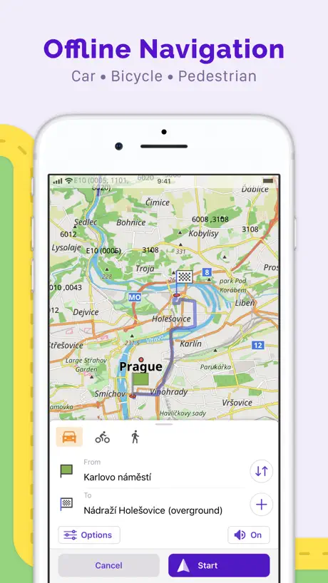
• Plotting a route to a place without an Internet connection;
• Customizable navigation profiles for different vehicles: cars, motorcycles, bicycles, 4x4, pedestrians, boats, public transport, and more;
• Change the constructed route, taking into account the exclusion of certain roads or road surfaces;
• Customizable information widgets about the route: distance, speed, remaining travel time, distance to turn, and more;

Route Planning and Recording
• Plotting a route point by point using one or multiple navigation profiles;
• Route recording using GPX tracks;
• Manage GPX tracks: displaying your own or imported GPX tracks on the map, navigating through them;
• Visual data about the route - descents/ascents, distances;
• Ability to share GPX track in OpenStreetMap;

Creation of points with different functionality
• Favourites;
• Markers;

OpenStreetMap
• Making edits to OSM;
• Updating maps with a frequency of up to one hour;

Additional features
• Compass and radius ruler;
• Mapillary interface;
• Night theme;
• Large community of users around the world, documentation, and support;


Paid features:


OsmAnd Maps+ (in-app or subscription):
• Unlimited map downloads;
• Topo data (Contour lines and Terrain);
• Nautical depths;
• Offline Wikipedia;
• Apple CarPlay support;

OsmAnd Pro (subscription):
• All Maps+ features;
• Weather forecast on the map online/offline;
• OsmAnd Cloud (backup and restore);
• Customize Route line;
• Hourly map updates.
Hide.. Show more..

In-Apps

Europe
129,00 kr
Wikipedia
0,00 kr
Nautical Map
19,00 kr
Contour lines
79,00 kr
All World Maps
179,00 kr
OsmAnd Pro annual
229,00 kr
OsmAnd Pro monthly
25,00 kr
OsmAnd Maps+ annual
79,00 kr
OsmAnd: All inclusive Annual
79,00 kr
OsmAnd: All Inclusive Monthly
15,00 kr

Screenshots

User Rating

4.54 out of 5

117 ratings in Denmark

5 star
82
4 star
25
3 star
4
2 star
3
1 star
3

Ratings History

Reviews

Man må ikke studere ruten

Trampedax on

Som overskriften siger, må man ikke studere ruten, hvergang jeg vil se ruten, returnere den hele tiden tilbage til start, hvilket gør at jeg ikke kan studere ruten, for at se hvilke steder man passere. Det får man ikke tid til, eller lov til, så køre bare tilbage til startpunk. Duer simpelt hen ikke.

Got too greedy

Randomize46 on

Liked the app before it started to charge additional in-apps for every single bit of functionality, now I am not even able to update maps I downloaded before because developers decided this time I need to purchase “continents” - ridiculous because maps use open data from OSM.

Clustered with orange spots

Bfans on

After the latest update the map is clustered with orange spots, making it impossible to use it properly. Could these spots be removed, or do I have to switch to CityMaps ToGo? Thanks to the Osmand Supporters the map now works again.

Map shows in 3 D mode - very annoying

Araaschou on

I cannot find any way to change to normal 2 D map viewing on my iPad

Not working

rasmusbilde on

Idea is nice, but navigation simply isn't working at all on my iPhone 4/iPad.

Good frontend for OpenStreetmap

Dans let on

The free Osmand is a very good app, but somewhat limited by the in app purchases.

ikke et søkort

KWPEDER on

det kan ikke noget på søen!

Store Rankings

Ranking History

Category Rankings

Chart
Category
Rank
Top Grossing
5
Top Grossing
8
Top Grossing
8
Top Grossing
10
Top Grossing
12

Keywords

Users may also like

Name
Guru Maps - Offline Navigation
Route Planner, Offroad Trails
Navitel Navigator
GPS navigation & Offline maps
Topo GPS - Topographic maps
gpx route viewer and planner
Open GPX Tracker
No ads, no in-app purchases
Magic Earth Navigation & Maps
Offline Maps, Traffic
Scenic Motorcycle Navigation
Plan, Ride & Track moto Routes
calimoto Motorbike Navigation
Top Motorbike Routes & GPS
GPX viewer
The paper map reinvented
Organic Maps Offline Hike Bike
Trails, Travel, GPS Navigation
دليلة البر
Show More

Revenue and Downloads

Gain valuable insights into OsmAnd Maps Travel & Navigate performance with our analytics. Sign up now to access downloads, revenue, and more.

App Info

Category
Travel
Publisher
OsmAND B.V.
Languages
English, Afrikaans, Albanian, Arabic, Aragonese, Armenian, Assamese, Azerbaijani, Basque, Belarusian, Bengali, Bosnian, Breton, Bulgarian, Burmese, Catalan, tz, ck, Croatian, Czech, Danish, Dutch, Esperanto, Estonian, Finnish, French, Galician, Georgian, German, Greek (modern), Hebrew (modern), Hindi, Hungarian, Icelandic, Indonesian, Interlingua, Italian, Japanese, Kannada, Korean, Kurdish, Latvian, Lithuanian, Macedonian, Malayalam, Marathi, Mongolian, Norwegian Bokmål, Norwegian Nynorsk, Occitan, Persian, Polish, Portuguese, Panjabi, Romanian, Russian, Sanskrit, Sardinian, Serbian, Chinese, Slovak, Slovene, Spanish, Swedish, Tamil, Tatar, Telugu, Turkish, Ukrainian, hs, Urdu, Uzbek, Vietnamese, Welsh
Recent version
4.7.6 (1 month ago )
Released on
Apr 21, 2015 (9 years ago )
Last updated
2 days ago